Shivpuri geodata
Shivpuri (Madhya Pradesh) is a populated place; located in India in Asia/Kolkata (GMT+5.5) time zone. With population of 164,215 people, there are 263 cities with bigger population in this country. Compared to other cities in India, 66.2% of cities are located further ↓South; 55.4% of cities are located further →East and 80.2% of cities have lower elevation than Shivpuri. Note1


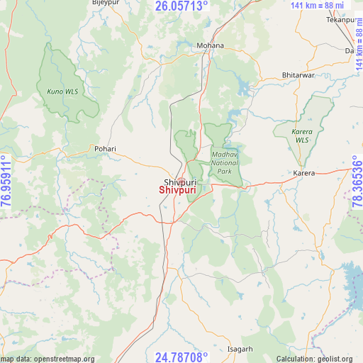
Shivpuri GPS coordinates[2]
25° 25' 25.608" North, 77° 39' 44.028" East
| Map corner | latitude | longitude |
|---|---|---|
| Upper-left | 26.05713°, | 76.95911° |
| Center: | 25.42378°, | 77.66223° |
| Lower-right: | 24.78708°, | 78.36536° |
| Map W x H: | 141.2×141.2 km | = 87.7×87.7mi |
| max Lat: | 34.9274° ⇑33.8% North |
| Shivpuri: | 25.42378° |
| min Lat: | ⇓66.2% South 8.09008° |
| min Long | Shivpuri | max Long |
| 68.82655° | 77.66223° | 96.81° |
| W 44.6%⇐ | ⇒55.4% E |
Elevation
Elevation of Shivpuri is 463 m = 1519 ft, and this is 167.4 m = 549 ft above average elevation for this country.
| Max E: |
3681 m = 12077 ft | 19.8% |
| Shivpuri | 463 m 1519 ft | |
| Avg. | 295.6 m = 970 ft | |
Min E: |
1 m = 3 ft | 80.2% |
See also: Shivpuri elevation on elevation.city.
Geographical zone
Shivpuri is located in North temperate zone (between Tropic of Cancer and the Arctic Circle). Distance of this Northern Tropic circle is 220.9 km =137.3 mi to South.| Distance of | km | miles | from Shivpuri |
|---|---|---|---|
| North Pole | 7180.2 | 4461.6 | to North |
| Arctic Circle | 4574.3 | 2842.3 | to North |
| Tropic Cancer | 220.9 | 137.3 | to South |
| Equator | 2826.9 | 1756.6 | to South |


Nearby cities:
15 places around Shivpuri: (largest is in red/bold)
• Antri
89.4 km =55.6 mi,  37°
37°
• Babīna
83.8 km =52.1 mi,  104°
104°
• Badarwās
50.8 km =31.6 mi,  191°
191°
• Bhitarwār
60.8 km =37.8 mi,  47°
47°
• Bijrauni
54.6 km =33.9 mi,  181°
181°
• Bāmor Kalān
76.8 km =47.7 mi,  140°
140°
• Dabra
84.5 km =52.5 mi, 52°
• Datia
84.6 km =52.6 mi,  70°
70°
• Isāgarh
68.7 km =42.7 mi,  161°
161°
• Karera
47.7 km =29.6 mi,  85°
85°
• Khailār
87.8 km =54.6 mi, 95°
• Kolāras
23.3 km =14.5 mi, 192°
• Narwar
35.1 km =21.8 mi, 45°
• Tekanpur
88.8 km =55.2 mi, 44°
• Tālbahat
88.4 km =54.9 mi,  118°
118°
Sources, notices
• [Note1] Compared only with cities in India existing in our database
• [Src1] Map data: © OpenStreetMap contributors (CC-BY-SA)
• [Src2] Other city data from geonames.org with taken over terms of usage.
• [Src3] Geographical zone / Annual Mean Temperature by Robert A. Rohde @ Wikipedia
