Pharihā geodata
Pharihā (Uttar Pradesh) is a populated place; located in India in Asia/Kolkata (GMT+5.5) time zone. With population of 6,380 people, there are 3261 cities with bigger population in this country. Compared to other cities in India, 80.9% of cities are located further ↓South; 53.9% of cities are located further ←West and 55.8% of cities have higher elevation than Pharihā. Note1


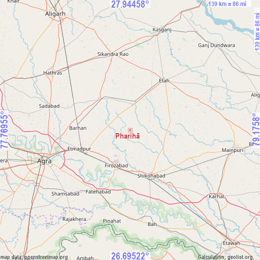
Pharihā GPS coordinates[2]
27° 19' 17.976" North, 78° 28' 21.612" East
| Map corner | latitude | longitude |
|---|---|---|
| Upper-left | 27.94458°, | 77.76955° |
| Center: | 27.32166°, | 78.47267° |
| Lower-right: | 26.69522°, | 79.1758° |
| Map W x H: | 138.9×138.9 km | = 86.3×86.3mi |
| max Lat: | 34.9274° ⇑19.1% North |
| Pharihā: | 27.32166° |
| min Lat: | ⇓80.9% South 8.09008° |
| min Long | Pharihā | max Long |
| 68.82655° | 78.47267° | 96.81° |
| W 53.9%⇐ | ⇒46.1% E |
Elevation
Elevation of Pharihā is 171 m = 561 ft, and this is 124.6 m = 409 ft below average elevation for this country.
| Max E: |
3681 m = 12077 ft | 55.8% |
| Avg. | 295.6 m = 970 ft | |
| Pharihā | 171 m = 561 ft | |
Min E: |
1 m = 3 ft | 44.2% |
See also: India elevation on elevation.city.
Geographical zone
Pharihā is located in North temperate zone (between Tropic of Cancer and the Arctic Circle). Distance of this Northern Tropic circle is 432 km =268.4 mi to South.| Distance of | km | miles | from Pharihā |
|---|---|---|---|
| North Pole | 6969.2 | 4330.5 | to North |
| Arctic Circle | 4363.3 | 2711.2 | to North |
| Tropic Cancer | 432 | 268.4 | to South |
| Equator | 3037.9 | 1887.7 | to South |


Nearby cities:
15 places around Pharihā: (largest is in red/bold)
• Agra
47.6 km =29.6 mi,  251°
251°
• Dayāl Bāgh
47 km =29.2 mi,  256°
256°
• Fatehābād
36.9 km =22.9 mi,  207°
207°
• Fīrozābād
20.4 km =12.7 mi,  201°
201°
• Ghiror
34.9 km =21.7 mi,  114°
114°
• Itimādpur
28.8 km =17.9 mi, 250°
• Jalesar
23.7 km =14.7 mi,  315°
315°
• Jasrāna
20.2 km =12.6 mi,  118°
118°
• Mārahra
47.1 km =29.3 mi,  11°
11°
• Sadābād
44.9 km =27.9 mi,  286°
286°
• Sakīt
32.8 km =20.4 mi,  67°
67°
• Shikohābād
26.3 km =16.3 mi,  154°
154°
• Sikandra Rao
41.8 km =26 mi,  347°
347°
• Sirsāganj
36.2 km =22.5 mi,  144°
144°
• Tūndla
26.2 km =16.3 mi,  242°
242°
Sources, notices
• [Note1] Compared only with cities in India existing in our database
• [Src1] Map data: © OpenStreetMap contributors (CC-BY-SA)
• [Src2] Other city data from geonames.org with taken over terms of usage.
• [Src3] Geographical zone / Annual Mean Temperature by Robert A. Rohde @ Wikipedia
