Sherghāti geodata
Sherghāti (Bihar) is a populated place; located in India in Asia/Kolkata (GMT+5.5) time zone. With population of 35,279 people, there are 1230 cities with bigger population in this country. Compared to other cities in India, 61% of cities are located further ↓South; 83.7% of cities are located further ←West and 59.5% of cities have higher elevation than Sherghāti. Note1


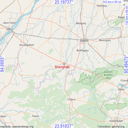
Sherghāti GPS coordinates[2]
24° 33' 34.2" North, 84° 47' 29.832" East
| Map corner | latitude | longitude |
|---|---|---|
| Upper-left | 25.19737°, | 84.0885° |
| Center: | 24.5595°, | 84.79162° |
| Lower-right: | 23.91837°, | 85.49475° |
| Map W x H: | 142.2×142.2 km | = 88.4×88.4mi |
| max Lat: | 34.9274° ⇑39% North |
| Sherghāti: | 24.5595° |
| min Lat: | ⇓61% South 8.09008° |
| min Long | Sherghāti | max Long |
| 68.82655° | 84.79162° | 96.81° |
| W 83.7%⇐ | ⇒16.3% E |
Elevation
Elevation of Sherghāti is 151 m = 495 ft, and this is 144.6 m = 474 ft below average elevation for this country.
| Max E: |
3681 m = 12077 ft | 59.5% |
| Avg. | 295.6 m = 970 ft | |
| Sherghāti | 151 m = 495 ft | |
Min E: |
1 m = 3 ft | 40.5% |
See also: India elevation on elevation.city.
Geographical zone
Sherghāti is located in North temperate zone (between Tropic of Cancer and the Arctic Circle). Distance of this Northern Tropic circle is 124.8 km =77.5 mi to South.| Distance of | km | miles | from Sherghāti |
|---|---|---|---|
| North Pole | 7276.3 | 4521.3 | to North |
| Arctic Circle | 4670.4 | 2902.1 | to North |
| Tropic Cancer | 124.8 | 77.5 | to South |
| Equator | 2730.8 | 1696.8 | to South |


Nearby cities:
15 places around Sherghāti: (largest is in red/bold)
• Aurangābād
47.3 km =29.4 mi,  296°
296°
• Bagaha
27.4 km =17 mi,  97°
97°
• Buddh Gaya
25 km =15.5 mi,  52°
52°
• Chatrā
40.1 km =24.9 mi,  168°
168°
• Daudnagar
65.9 km =40.9 mi,  323°
323°
• Dehri
72.4 km =45 mi, 301°
• Gaya
34 km =21.1 mi,  39°
39°
• Hisuā
70.2 km =43.6 mi,  64°
64°
• Jahānābād
75.4 km =46.9 mi,  15°
15°
• Jumri Tilaiyā
75.9 km =47.2 mi, 100°
• Nabīnagar
67.5 km =41.9 mi,  274°
274°
• Nāsriganj
72 km =44.7 mi, 319°
• Rafiganj
32.8 km =20.4 mi,  331°
331°
• Tekāri
42.9 km =26.7 mi,  6°
6°
• patamda
69.5 km =43.2 mi,  114°
114°
Sources, notices
• [Note1] Compared only with cities in India existing in our database
• [Src1] Map data: © OpenStreetMap contributors (CC-BY-SA)
• [Src2] Other city data from geonames.org with taken over terms of usage.
• [Src3] Geographical zone / Annual Mean Temperature by Robert A. Rohde @ Wikipedia
