Dehri geodata
Dehri (Bihar) is a populated place; located in India in Asia/Kolkata (GMT+5.5) time zone. With population of 129,938 people, there are 337 cities with bigger population in this country. Compared to other cities in India, 63% of cities are located further ↓South; 82.4% of cities are located further ←West and 65.8% of cities have higher elevation than Dehri. Note1


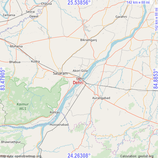
Dehri GPS coordinates[2]
24° 54' 8.892" North, 84° 10' 55.812" East
| Map corner | latitude | longitude |
|---|---|---|
| Upper-left | 25.53856°, | 83.47905° |
| Center: | 24.90247°, | 84.18217° |
| Lower-right: | 24.26308°, | 84.8853° |
| Map W x H: | 141.8×141.8 km | = 88.1×88.1mi |
| max Lat: | 34.9274° ⇑37% North |
| Dehri: | 24.90247° |
| min Lat: | ⇓63% South 8.09008° |
| min Long | Dehri | max Long |
| 68.82655° | 84.18217° | 96.81° |
| W 82.4%⇐ | ⇒17.6% E |
Elevation
Elevation of Dehri is 114 m = 374 ft, and this is 181.6 m = 596 ft below average elevation for this country.
| Max E: |
3681 m = 12077 ft | 65.8% |
| Avg. | 295.6 m = 970 ft | |
| Dehri | 114 m = 374 ft | |
Min E: |
1 m = 3 ft | 34.2% |
See also: Dehri elevation on elevation.city.
Geographical zone
Dehri is located in North temperate zone (between Tropic of Cancer and the Arctic Circle). Distance of this Northern Tropic circle is 163 km =101.3 mi to South.| Distance of | km | miles | from Dehri |
|---|---|---|---|
| North Pole | 7238.2 | 4497.6 | to North |
| Arctic Circle | 4632.3 | 2878.4 | to North |
| Tropic Cancer | 163 | 101.3 | to South |
| Equator | 2768.9 | 1720.5 | to South |


Nearby cities:
15 places around Dehri: (largest is in red/bold)
• Aurangābād
25.6 km =15.9 mi,  130°
130°
• Bhabhua
59.9 km =37.2 mi,  284°
284°
• Bikramganj
35.1 km =21.8 mi,  12°
12°
• Buxar
77.5 km =48.2 mi,  344°
344°
• Daudnagar
26.5 km =16.5 mi,  56°
56°
• Dumraon
72.4 km =45 mi,  357°
357°
• Husainābād
45.5 km =28.3 mi,  203°
203°
• Jagdīspur
67.3 km =41.8 mi,  20°
20°
• Koāth
47.8 km =29.7 mi, 9°
• Nabīnagar
33.4 km =20.8 mi,  189°
189°
• Nāsriganj
22.2 km =13.8 mi,  41°
41°
• Piro
52.8 km =32.8 mi,  25°
25°
• Rafiganj
46.6 km =29 mi,  101°
101°
• Sherghāti
72.4 km =45 mi,  121°
121°
• Tekāri
66.7 km =41.4 mi,  86°
86°
Sources, notices
• [Note1] Compared only with cities in India existing in our database
• [Src1] Map data: © OpenStreetMap contributors (CC-BY-SA)
• [Src2] Other city data from geonames.org with taken over terms of usage.
• [Src3] Geographical zone / Annual Mean Temperature by Robert A. Rohde @ Wikipedia
