Bikramganj geodata
Bikramganj (Bihar) is a populated place; located in India in Asia/Kolkata (GMT+5.5) time zone. With population of 42,626 people, there are 1035 cities with bigger population in this country. Compared to other cities in India, 64.6% of cities are located further ↓South; 82.5% of cities are located further ←West and 69.8% of cities have higher elevation than Bikramganj. Note1


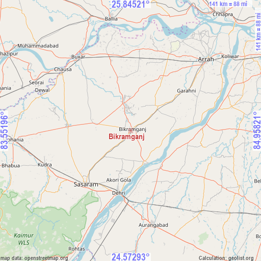
Bikramganj GPS coordinates[2]
25° 12' 38.628" North, 84° 15' 18.288" East
| Map corner | latitude | longitude |
|---|---|---|
| Upper-left | 25.84521°, | 83.55196° |
| Center: | 25.21073°, | 84.25508° |
| Lower-right: | 24.57293°, | 84.95821° |
| Map W x H: | 141.5×141.5 km | = 87.9×87.9mi |
| max Lat: | 34.9274° ⇑35.4% North |
| Bikramganj: | 25.21073° |
| min Lat: | ⇓64.6% South 8.09008° |
| min Long | Bikramganj | max Long |
| 68.82655° | 84.25508° | 96.81° |
| W 82.5%⇐ | ⇒17.5% E |
Elevation
Elevation of Bikramganj is 93 m = 305 ft, and this is 202.6 m = 665 ft below average elevation for this country.
| Max E: |
3681 m = 12077 ft | 69.8% |
| Avg. | 295.6 m = 970 ft | |
| Bikramganj | 93 m = 305 ft | |
Min E: |
1 m = 3 ft | 30.2% |
See also: Bikramganj elevation on elevation.city.
Geographical zone
Bikramganj is located in North temperate zone (between Tropic of Cancer and the Arctic Circle). Distance of this Northern Tropic circle is 197.3 km =122.6 mi to South.| Distance of | km | miles | from Bikramganj |
|---|---|---|---|
| North Pole | 7203.9 | 4476.3 | to North |
| Arctic Circle | 4598 | 2857.1 | to North |
| Tropic Cancer | 197.3 | 122.6 | to South |
| Equator | 2803.2 | 1741.8 | to South |


Nearby cities:
15 places around Bikramganj: (largest is in red/bold)
• Arrah
56.2 km =34.9 mi,  46°
46°
• Aurangābād
52.4 km =32.6 mi,  166°
166°
• Bhabhua
67.9 km =42.2 mi,  253°
253°
• Buxar
49.1 km =30.5 mi,  325°
325°
• Daudnagar
24.5 km =15.2 mi,  143°
143°
• Dehri
35.1 km =21.8 mi,  192°
192°
• Dumraon
39.4 km =24.5 mi,  344°
344°
• Jagdīspur
33 km =20.5 mi,  29°
29°
• Koāth
12.9 km =8 mi,  2°
2°
• Muhammadābād
67.6 km =42 mi,  312°
312°
• Nāsriganj
19.2 km =11.9 mi,  157°
157°
• Piro
20.2 km =12.6 mi, 48°
• Rafiganj
58.1 km =36.1 mi, 138°
• Shāhpur
46.1 km =28.6 mi,  18°
18°
• Tekāri
66.3 km =41.2 mi,  116°
116°
Sources, notices
• [Note1] Compared only with cities in India existing in our database
• [Src1] Map data: © OpenStreetMap contributors (CC-BY-SA)
• [Src2] Other city data from geonames.org with taken over terms of usage.
• [Src3] Geographical zone / Annual Mean Temperature by Robert A. Rohde @ Wikipedia
