Khuldābād geodata
Khuldābād (Maharashtra) is a populated place; located in India in Asia/Kolkata (GMT+5.5) time zone. With population of 15,213 people, there are 2442 cities with bigger population in this country. Compared to other cities in India, 65.2% of cities are located further ↑North; 81.1% of cities are located further →East and 92.8% of cities have lower elevation than Khuldābād. Note1


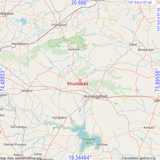
Khuldābād GPS coordinates[2]
20° 0' 24.156" North, 75° 11' 32.82" East
| Map corner | latitude | longitude |
|---|---|---|
| Upper-left | 20.666°, | 74.48933° |
| Center: | 20.00671°, | 75.19245° |
| Lower-right: | 19.34464°, | 75.89558° |
| Map W x H: | 146.9×146.9 km | = 91.3×91.3mi |
| max Lat: | 34.9274° ⇑65.2% North |
| Khuldābād: | 20.00671° |
| min Lat: | ⇓34.8% South 8.09008° |
| min Long | Khuldābād | max Long |
| 68.82655° | 75.19245° | 96.81° |
| W 18.9%⇐ | ⇒81.1% E |
Elevation
Elevation of Khuldābād is 734 m = 2408 ft, and this is 438.4 m = 1438 ft above average elevation for this country.
| Max E: |
3681 m = 12077 ft | 7.2% |
| Khuldābād | 734 m 2408 ft | |
| Avg. | 295.6 m = 970 ft | |
Min E: |
1 m = 3 ft | 92.8% |
See also: India elevation on elevation.city.
Geographical zone
Khuldābād is located in North Torrid zone (between Equator and Tropic of Cancer). Distance of this Northern Tropic circle is 381.4 km =237 mi to North.| Distance of | km | miles | from Khuldābād |
|---|---|---|---|
| North Pole | 7782.5 | 4835.8 | to North |
| Arctic Circle | 5176.6 | 3216.6 | to North |
| Tropic Cancer | 381.4 | 237 | to North |
| Equator | 2224.5 | 1382.2 | to South |


Nearby cities:
15 places around Khuldābād: (largest is in red/bold)
• Aurangabad
21.2 km =13.2 mi,  132°
132°
• Chālisgaon
53.4 km =33.2 mi,  339°
339°
• Daulatābād
8.4 km =5.2 mi,  158°
158°
• Ellora
3.6 km =2.2 mi,  300°
300°
• Gangāpur
39.3 km =24.4 mi,  208°
208°
• Jālna
74.8 km =46.5 mi,  104°
104°
• Kannad
28.4 km =17.6 mi,  348°
348°
• Kopargaon
76.1 km =47.3 mi,  259°
259°
• Nāndgaon
65.3 km =40.6 mi, 300°
• Paithan
62.5 km =38.8 mi, 161°
• Pāchora
75.3 km =46.8 mi,  12°
12°
• Pīpri
43 km =26.7 mi,  123°
123°
• Sillod
58.3 km =36.2 mi,  55°
55°
• Vaijāpur
49.4 km =30.7 mi, 259°
• Yeola
73.5 km =45.7 mi,  273°
273°
Sources, notices
• [Note1] Compared only with cities in India existing in our database
• [Src1] Map data: © OpenStreetMap contributors (CC-BY-SA)
• [Src2] Other city data from geonames.org with taken over terms of usage.
• [Src3] Geographical zone / Annual Mean Temperature by Robert A. Rohde @ Wikipedia
