Māchalpur geodata
Māchalpur (Madhya Pradesh) is a populated place; located in India in Asia/Kolkata (GMT+5.5) time zone. With population of 8,556 people, there are 3074 cities with bigger population in this country. Compared to other cities in India, 58.7% of cities are located further ↓South; 70.4% of cities are located further →East and 76.5% of cities have lower elevation than Māchalpur. Note1


Māchalpur GPS coordinates[2]
24° 7' 39.612" North, 76° 19' 0.192" East
| Map corner | latitude | longitude |
|---|---|---|
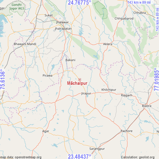
| Upper-left | 24.76775°, | 75.6136° |
| Center: | 24.12767°, | 76.31672° |
| Lower-right: | 23.48437°, | 77.01985° |
| Map W x H: | 142.7×142.7 km | = 88.7×88.7mi |
| max Lat: | 34.9274° ⇑41.3% North |
| Māchalpur: | 24.12767° |
| min Lat: | ⇓58.7% South 8.09008° |
| min Long | Māchalpur | max Long |
| 68.82655° | 76.31672° | 96.81° |
| W 29.6%⇐ | ⇒70.4% E |
Elevation
Elevation of Māchalpur is 407 m = 1335 ft, and this is 111.4 m = 365 ft above average elevation for this country.
| Max E: |
3681 m = 12077 ft | 23.5% |
| Māchalpur | 407 m 1335 ft | |
| Avg. | 295.6 m = 970 ft | |
Min E: |
1 m = 3 ft | 76.5% |
See also: India elevation on elevation.city.
Geographical zone
Māchalpur is located in North temperate zone (between Tropic of Cancer and the Arctic Circle). Distance of this Northern Tropic circle is 76.8 km =47.7 mi to South.| Distance of | km | miles | from Māchalpur |
|---|---|---|---|
| North Pole | 7324.3 | 4551.1 | to North |
| Arctic Circle | 4718.4 | 2931.9 | to North |
| Tropic Cancer | 76.8 | 47.7 | to South |
| Equator | 2682.7 | 1667 | to South |


Nearby cities:
15 places around Māchalpur: (largest is in red/bold)
• Agar
55.4 km =34.4 mi,  213°
213°
• Aklera
40.6 km =25.2 mi,  38°
38°
• Bakāni
19.4 km =12.1 mi,  335°
335°
• Bhawāniganj
58.4 km =36.3 mi,  303°
303°
• Jhālrapātan
48.3 km =30 mi, 342°
• Jhālāwār
54.3 km =33.7 mi, 343°
• Khilchipur
28.3 km =17.6 mi,  110°
110°
• Khujner
48.8 km =30.3 mi,  141°
141°
• Manohar Thāna
50.8 km =31.6 mi,  75°
75°
• Pirāwa
29.5 km =18.3 mi,  275°
275°
• Rājgarh
44.3 km =27.5 mi, 107°
• Suket
64 km =39.8 mi,  334°
334°
• Sunel
45.4 km =28.2 mi,  306°
306°
• Susner
30.7 km =19.1 mi,  229°
229°
• Sārangpur
64.4 km =40 mi,  165°
165°
Sources, notices
• [Note1] Compared only with cities in India existing in our database
• [Src1] Map data: © OpenStreetMap contributors (CC-BY-SA)
• [Src2] Other city data from geonames.org with taken over terms of usage.
• [Src3] Geographical zone / Annual Mean Temperature by Robert A. Rohde @ Wikipedia
