Jashpurnagar geodata
Jashpurnagar (Chhattisgarh) is a populated place; located in India in Asia/Kolkata (GMT+5.5) time zone. With population of 22,607 people, there are 1866 cities with bigger population in this country. Compared to other cities in India, 50.8% of cities are located further ↓South; 82.3% of cities are located further ←West and 93.5% of cities have lower elevation than Jashpurnagar. Note1


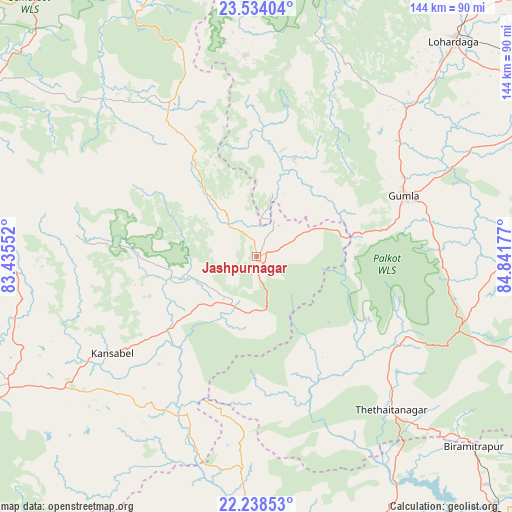
Jashpurnagar GPS coordinates[2]
22° 53' 16.188" North, 84° 8' 19.104" East
| Map corner | latitude | longitude |
|---|---|---|
| Upper-left | 23.53404°, | 83.43552° |
| Center: | 22.88783°, | 84.13864° |
| Lower-right: | 22.23853°, | 84.84177° |
| Map W x H: | 144×144 km | = 89.5×89.5mi |
| max Lat: | 34.9274° ⇑49.2% North |
| Jashpurnagar: | 22.88783° |
| min Lat: | ⇓50.8% South 8.09008° |
| min Long | Jashpurnagar | max Long |
| 68.82655° | 84.13864° | 96.81° |
| W 82.3%⇐ | ⇒17.7% E |
Elevation
Elevation of Jashpurnagar is 776 m = 2546 ft, and this is 480.4 m = 1576 ft above average elevation for this country.
| Max E: |
3681 m = 12077 ft | 6.5% |
| Jashpurnagar | 776 m 2546 ft | |
| Avg. | 295.6 m = 970 ft | |
Min E: |
1 m = 3 ft | 93.5% |
See also: India elevation on elevation.city.
Geographical zone
Jashpurnagar is located in North Torrid zone (between Equator and Tropic of Cancer). Distance of this Northern Tropic circle is 61 km =37.9 mi to North.| Distance of | km | miles | from Jashpurnagar |
|---|---|---|---|
| North Pole | 7462.2 | 4636.8 | to North |
| Arctic Circle | 4856.3 | 3017.6 | to North |
| Tropic Cancer | 61 | 37.9 | to North |
| Equator | 2544.9 | 1581.3 | to South |


Nearby cities:
15 places around Jashpurnagar: (largest is in red/bold)
• Ambikāpur
99.9 km =62.1 mi,  284°
284°
• Balrampur
96.9 km =60.2 mi,  326°
326°
• Barwādih
106.8 km =66.4 mi,  358°
358°
• Birmitrapur
84.2 km =52.3 mi,  130°
130°
• Bānposh
99.1 km =61.6 mi,  135°
135°
• Gharghoda
113.3 km =70.4 mi,  225°
225°
• Gumlā
45 km =28 mi,  67°
67°
• Lohārdagā
82.1 km =51 mi,  42°
42°
• Lātehār
102.1 km =63.4 mi,  21°
21°
• Neturhāt
66.6 km =41.4 mi,  11°
11°
• Pathalgaon
78.4 km =48.7 mi,  241°
241°
• Raurkela
104.8 km =65.1 mi, 134°
• Rāmānuj Ganj
111.5 km =69.3 mi,  336°
336°
• Simdega
48 km =29.8 mi, 129°
• Sundargarh
86.4 km =53.7 mi,  187°
187°
Sources, notices
• [Note1] Compared only with cities in India existing in our database
• [Src1] Map data: © OpenStreetMap contributors (CC-BY-SA)
• [Src2] Other city data from geonames.org with taken over terms of usage.
• [Src3] Geographical zone / Annual Mean Temperature by Robert A. Rohde @ Wikipedia
