Lohārdagā geodata
Lohārdagā (Jharkhand) is a populated place; located in India in Asia/Kolkata (GMT+5.5) time zone. With population of 53,032 people, there are 840 cities with bigger population in this country. Compared to other cities in India, 54.5% of cities are located further ↓South; 83.5% of cities are located further ←West and 91.4% of cities have lower elevation than Lohārdagā. Note1


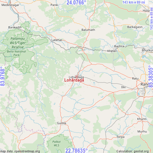
Lohārdagā GPS coordinates[2]
23° 25' 58.98" North, 84° 40' 47.712" East
| Map corner | latitude | longitude |
|---|---|---|
| Upper-left | 24.0766°, | 83.9768° |
| Center: | 23.43305°, | 84.67992° |
| Lower-right: | 22.78635°, | 85.38305° |
| Map W x H: | 143.5×143.5 km | = 89.2×89.2mi |
| max Lat: | 34.9274° ⇑45.5% North |
| Lohārdagā: | 23.43305° |
| min Lat: | ⇓54.5% South 8.09008° |
| min Long | Lohārdagā | max Long |
| 68.82655° | 84.67992° | 96.81° |
| W 83.5%⇐ | ⇒16.5% E |
Elevation
Elevation of Lohārdagā is 666 m = 2185 ft, and this is 370.4 m = 1215 ft above average elevation for this country.
| Max E: |
3681 m = 12077 ft | 8.6% |
| Lohārdagā | 666 m 2185 ft | |
| Avg. | 295.6 m = 970 ft | |
Min E: |
1 m = 3 ft | 91.4% |
See also: Lohārdagā elevation on elevation.city.
Geographical zone
Lohārdagā is located in North Torrid zone (between Equator and Tropic of Cancer). Distance of this Northern Tropic circle is 0.4 km =0.2 mi to North.| Distance of | km | miles | from Lohārdagā |
|---|---|---|---|
| North Pole | 7401.6 | 4599.1 | to North |
| Arctic Circle | 4795.7 | 2979.9 | to North |
| Tropic Cancer | 0.4 | 0.2 | to North |
| Equator | 2605.5 | 1619 | to South |


Nearby cities:
15 places around Lohārdagā: (largest is in red/bold)
• Barkā Kānā
83 km =51.6 mi,  75°
75°
• Barwādih
74.1 km =46 mi,  308°
308°
• Chatrā
88.2 km =54.8 mi,  12°
12°
• Daltonganj
92 km =57.2 mi,  317°
317°
• Gumlā
45.6 km =28.3 mi,  197°
197°
• Jashpurnagar
82.1 km =51 mi,  222°
222°
• Khunti
72.9 km =45.3 mi,  123°
123°
• Kuju
90.6 km =56.3 mi,  68°
68°
• Kānke
65.4 km =40.6 mi,  89°
89°
• Lātehār
39.2 km =24.4 mi,  332°
332°
• Neturhāt
42.3 km =26.3 mi,  276°
276°
• Ranchi
65 km =40.4 mi,  98°
98°
• Rāmgarh
88.6 km =55.1 mi, 75°
• Rāy
47.3 km =29.4 mi,  53°
53°
• Simdega
92.7 km =57.6 mi,  191°
191°
Sources, notices
• [Note1] Compared only with cities in India existing in our database
• [Src1] Map data: © OpenStreetMap contributors (CC-BY-SA)
• [Src2] Other city data from geonames.org with taken over terms of usage.
• [Src3] Geographical zone / Annual Mean Temperature by Robert A. Rohde @ Wikipedia
