Gumlā geodata
Gumlā (Jharkhand) is a populated place; located in India in Asia/Kolkata (GMT+5.5) time zone. With population of 44,951 people, there are 987 cities with bigger population in this country. Compared to other cities in India, 52% of cities are located further ↓South; 83.2% of cities are located further ←West and 90.9% of cities have lower elevation than Gumlā. Note1


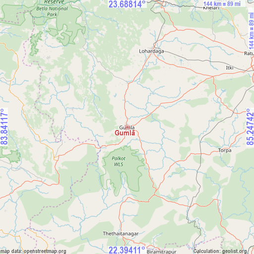
Gumlā GPS coordinates[2]
23° 2' 33.648" North, 84° 32' 39.444" East
| Map corner | latitude | longitude |
|---|---|---|
| Upper-left | 23.68814°, | 83.84117° |
| Center: | 23.04268°, | 84.54429° |
| Lower-right: | 22.39411°, | 85.24742° |
| Map W x H: | 143.9×143.9 km | = 89.4×89.4mi |
| max Lat: | 34.9274° ⇑48% North |
| Gumlā: | 23.04268° |
| min Lat: | ⇓52% South 8.09008° |
| min Long | Gumlā | max Long |
| 68.82655° | 84.54429° | 96.81° |
| W 83.2%⇐ | ⇒16.8% E |
Elevation
Elevation of Gumlā is 650 m = 2133 ft, and this is 354.4 m = 1163 ft above average elevation for this country.
| Max E: |
3681 m = 12077 ft | 9.1% |
| Gumlā | 650 m 2133 ft | |
| Avg. | 295.6 m = 970 ft | |
Min E: |
1 m = 3 ft | 90.9% |
See also: Gumlā elevation on elevation.city.
Geographical zone
Gumlā is located in North Torrid zone (between Equator and Tropic of Cancer). Distance of this Northern Tropic circle is 43.8 km =27.2 mi to North.| Distance of | km | miles | from Gumlā |
|---|---|---|---|
| North Pole | 7445 | 4626.1 | to North |
| Arctic Circle | 4839.1 | 3006.9 | to North |
| Tropic Cancer | 43.8 | 27.2 | to North |
| Equator | 2562.1 | 1592 | to South |


Nearby cities:
15 places around Gumlā: (largest is in red/bold)
• Barwādih
99.9 km =62.1 mi,  333°
333°
• Birmitrapur
75 km =46.6 mi,  162°
162°
• Bānposh
92.4 km =57.4 mi, 162°
• Būndu
107.8 km =67 mi,  82°
82°
• Jashpurnagar
45 km =28 mi,  247°
247°
• Khunti
75.2 km =46.7 mi,  87°
87°
• Kānke
90.5 km =56.2 mi,  61°
61°
• Lohārdagā
45.6 km =28.3 mi,  17°
17°
• Lātehār
78.1 km =48.5 mi,  356°
356°
• Manoharpur
99.7 km =62 mi,  138°
138°
• Neturhāt
55.7 km =34.6 mi, 329°
• Ranchi
85 km =52.8 mi,  66°
66°
• Raurkela
96.7 km =60.1 mi, 160°
• Rāy
88.3 km =54.9 mi,  36°
36°
• Simdega
47.7 km =29.6 mi,  185°
185°
Sources, notices
• [Note1] Compared only with cities in India existing in our database
• [Src1] Map data: © OpenStreetMap contributors (CC-BY-SA)
• [Src2] Other city data from geonames.org with taken over terms of usage.
• [Src3] Geographical zone / Annual Mean Temperature by Robert A. Rohde @ Wikipedia
