Hosakote geodata
Hosakote (Karnataka) is a populated place; located in India in Asia/Kolkata (GMT+5.5) time zone. With population of 11,692 people, there are 2766 cities with bigger population in this country. Compared to other cities in India, 82.8% of cities are located further ↑North; 61.3% of cities are located further →East and 89.6% of cities have lower elevation than Hosakote. Note1


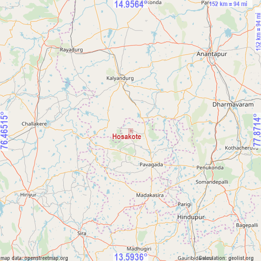
Hosakote GPS coordinates[2]
14° 16' 33.708" North, 77° 10' 5.772" East
| Map corner | latitude | longitude |
|---|---|---|
| Upper-left | 14.9564°, | 76.46515° |
| Center: | 14.27603°, | 77.16827° |
| Lower-right: | 13.5936°, | 77.8714° |
| Map W x H: | 151.5×151.5 km | = 94.1×94.1mi |
| max Lat: | 34.9274° ⇑82.8% North |
| Hosakote: | 14.27603° |
| min Lat: | ⇓17.2% South 8.09008° |
| min Long | Hosakote | max Long |
| 68.82655° | 77.16827° | 96.81° |
| W 38.7%⇐ | ⇒61.3% E |
Elevation
Elevation of Hosakote is 628 m = 2060 ft, and this is 332.4 m = 1091 ft above average elevation for this country.
| Max E: |
3681 m = 12077 ft | 10.4% |
| Hosakote | 628 m 2060 ft | |
| Avg. | 295.6 m = 970 ft | |
Min E: |
1 m = 3 ft | 89.6% |
See also: India elevation on elevation.city.
Geographical zone
Hosakote is located in North Torrid zone (between Equator and Tropic of Cancer). Distance of this Northern Tropic circle is 1018.6 km =632.9 mi to North.| Distance of | km | miles | from Hosakote |
|---|---|---|---|
| North Pole | 8419.7 | 5231.8 | to North |
| Arctic Circle | 5813.8 | 3612.5 | to North |
| Tropic Cancer | 1018.6 | 632.9 | to North |
| Equator | 1587.3 | 986.3 | to South |


Nearby cities:
15 places around Hosakote: (largest is in red/bold)
• Anantapur
65.1 km =40.5 mi,  46°
46°
• Challakere
55.9 km =34.7 mi,  274°
274°
• Dharmavaram
61.4 km =38.2 mi,  75°
75°
• Gorantla
72.8 km =45.2 mi,  116°
116°
• Hindupur
60.8 km =37.8 mi,  145°
145°
• Hiriyūr
69.9 km =43.4 mi,  238°
238°
• Kalyandurg
30.7 km =19.1 mi,  347°
347°
• Kodigenahalli
66 km =41 mi,  159°
159°
• Maddagiri
68.6 km =42.6 mi,  176°
176°
• Penukonda
50.7 km =31.5 mi, 115°
• Puttaparthi
70.4 km =43.7 mi,  100°
100°
• Pāvugada
23 km =14.3 mi, 148°
• Rāyadrug
58.1 km =36.1 mi,  324°
324°
• Sīra
65.9 km =40.9 mi,  205°
205°
• Uravakonda
74.8 km =46.5 mi,  7°
7°
Sources, notices
• [Note1] Compared only with cities in India existing in our database
• [Src1] Map data: © OpenStreetMap contributors (CC-BY-SA)
• [Src2] Other city data from geonames.org with taken over terms of usage.
• [Src3] Geographical zone / Annual Mean Temperature by Robert A. Rohde @ Wikipedia
