Dhandhuka geodata
Dhandhuka (Gujarat) is a populated place; located in India in Asia/Kolkata (GMT+5.5) time zone. With population of 30,049 people, there are 1440 cities with bigger population in this country. Compared to other cities in India, 53.8% of cities are located further ↑North; 97.4% of cities are located further →East and 84.7% of cities have higher elevation than Dhandhuka. Note1


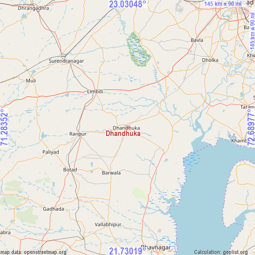
Dhandhuka GPS coordinates[2]
22° 22' 54.66" North, 71° 59' 11.904" East
| Map corner | latitude | longitude |
|---|---|---|
| Upper-left | 23.03048°, | 71.28352° |
| Center: | 22.38185°, | 71.98664° |
| Lower-right: | 21.73019°, | 72.68977° |
| Map W x H: | 144.6×144.6 km | = 89.9×89.9mi |
| max Lat: | 34.9274° ⇑53.8% North |
| Dhandhuka: | 22.38185° |
| min Lat: | ⇓46.2% South 8.09008° |
| min Long | Dhandhuka | max Long |
| 68.82655° | 71.98664° | 96.81° |
| W 2.6%⇐ | ⇒97.4% E |
Elevation
Elevation of Dhandhuka is 31 m = 102 ft, and this is 264.6 m = 868 ft below average elevation for this country.
| Max E: |
3681 m = 12077 ft | 84.7% |
| Avg. | 295.6 m = 970 ft | |
| Dhandhuka | 31 m = 102 ft | |
Min E: |
1 m = 3 ft | 15.3% |
See also: India elevation on elevation.city.
Geographical zone
Dhandhuka is located in North Torrid zone (between Equator and Tropic of Cancer). Distance of this Northern Tropic circle is 117.3 km =72.9 mi to North.| Distance of | km | miles | from Dhandhuka |
|---|---|---|---|
| North Pole | 7518.4 | 4671.7 | to North |
| Arctic Circle | 4912.5 | 3052.5 | to North |
| Tropic Cancer | 117.3 | 72.9 | to North |
| Equator | 2488.6 | 1546.3 | to South |


Nearby cities:
15 places around Dhandhuka: (largest is in red/bold)
• Bhavnagar
70.9 km =44.1 mi,  165°
165°
• Botād
40.5 km =25.2 mi,  234°
234°
• Dhola
59.9 km =37.2 mi,  201°
201°
• Dholka
60.5 km =37.6 mi,  50°
50°
• Gadhada
62.2 km =38.6 mi,  222°
222°
• Khambhāt
65.4 km =40.6 mi,  96°
96°
• Lakhtar
56.6 km =35.2 mi,  338°
338°
• Limbdi
27.2 km =16.9 mi,  318°
318°
• Pāliyād
46 km =28.6 mi,  252°
252°
• Surendranagar
51.8 km =32.2 mi, 317°
• Sāyla
55 km =34.2 mi,  289°
289°
• Umrāla
62.8 km =39 mi, 197°
• Valabhīpur
55.9 km =34.7 mi,  191°
191°
• Vartej
71.9 km =44.7 mi, 173°
• Vinchia
65.3 km =40.6 mi, 253°
Sources, notices
• [Note1] Compared only with cities in India existing in our database
• [Src1] Map data: © OpenStreetMap contributors (CC-BY-SA)
• [Src2] Other city data from geonames.org with taken over terms of usage.
• [Src3] Geographical zone / Annual Mean Temperature by Robert A. Rohde @ Wikipedia
