Banganapalle geodata
Banganapalle (Andhra Pradesh) is a populated place; located in India in Asia/Kolkata (GMT+5.5) time zone. With population of 25,325 people, there are 1677 cities with bigger population in this country. Compared to other cities in India, 80.7% of cities are located further ↑North; 51.5% of cities are located further ←West and 56.2% of cities have lower elevation than Banganapalle. Note1


Banganapalle GPS coordinates[2]
15° 19' 3.756" North, 78° 13' 36.084" East
| Map corner | latitude | longitude |
|---|---|---|
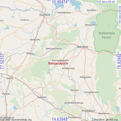
| Upper-left | 15.99474°, | 77.52357° |
| Center: | 15.31771°, | 78.22669° |
| Lower-right: | 14.63848°, | 78.92982° |
| Map W x H: | 150.8×150.8 km | = 93.7×93.7mi |
| max Lat: | 34.9274° ⇑80.7% North |
| Banganapalle: | 15.31771° |
| min Lat: | ⇓19.3% South 8.09008° |
| min Long | Banganapalle | max Long |
| 68.82655° | 78.22669° | 96.81° |
| W 51.5%⇐ | ⇒48.5% E |
Elevation
Elevation of Banganapalle is 231 m = 758 ft, and this is 64.6 m = 212 ft below average elevation for this country.
| Max E: |
3681 m = 12077 ft | 43.8% |
| Avg. | 295.6 m = 970 ft | |
| Banganapalle | 231 m = 758 ft | |
Min E: |
1 m = 3 ft | 56.2% |
See also: India elevation on elevation.city.
Geographical zone
Banganapalle is located in North Torrid zone (between Equator and Tropic of Cancer). Distance of this Northern Tropic circle is 902.7 km =560.9 mi to North.| Distance of | km | miles | from Banganapalle |
|---|---|---|---|
| North Pole | 8303.9 | 5159.8 | to North |
| Arctic Circle | 5698 | 3540.6 | to North |
| Tropic Cancer | 902.7 | 560.9 | to North |
| Equator | 1703.2 | 1058.3 | to South |


Nearby cities:
15 places around Banganapalle: (largest is in red/bold)
• Atmakūr
73.6 km =45.7 mi,  31°
31°
• Betamcherla
17.1 km =10.6 mi,  330°
330°
• Dhone
39 km =24.2 mi,  282°
282°
• Diguvametta
65.2 km =40.5 mi,  82°
82°
• Erraguntla
82.7 km =51.4 mi,  155°
155°
• Giddalūr
75.3 km =46.8 mi,  85°
85°
• Jammalamadugu
55 km =34.2 mi, 162°
• Kurnool
60.4 km =37.5 mi,  340°
340°
• Kāmalāpuram
93.1 km =57.8 mi,  149°
149°
• Nandikotkūr
60.1 km =37.3 mi,  3°
3°
• Nandyāl
32.8 km =20.4 mi,  57°
57°
• Proddatūr
71.9 km =44.7 mi, 151°
• Rāmāpuram
38.7 km =24 mi,  265°
265°
• Tādpatri
51.1 km =31.8 mi,  207°
207°
• Ālampur
63.3 km =39.3 mi,  350°
350°
Sources, notices
• [Note1] Compared only with cities in India existing in our database
• [Src1] Map data: © OpenStreetMap contributors (CC-BY-SA)
• [Src2] Other city data from geonames.org with taken over terms of usage.
• [Src3] Geographical zone / Annual Mean Temperature by Robert A. Rohde @ Wikipedia
