Ḩalabjah al Jadīdah geodata
Ḩalabjah al Jadīdah (Sulaymaniyah) is a seat of a second-order administrative division; located in Iraq in Asia/Baghdad (GMT+3) time zone. In our database, there are 71 cities with bigger population. Compared to other cities in Iraq, 62% of cities are located further ↓South; 79.6% of cities are located further ←West and 78.9% of cities have lower elevation than Ḩalabjah al Jadīdah. Note1


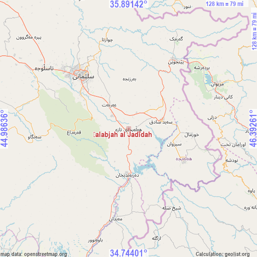
Ḩalabjah al Jadīdah GPS coordinates[2]
35° 19' 11.1" North, 45° 41' 22.128" East
| Map corner | latitude | longitude |
|---|---|---|
| Upper-left | 35.89142°, | 44.98636° |
| Center: | 35.31975°, | 45.68948° |
| Lower-right: | 34.74401°, | 46.39261° |
| Map W x H: | 127.6×127.6 km | = 79.3×79.3mi |
| max Lat: | 37.22781° ⇑38% North |
| Ḩalabjah al Jadīdah: | 35.31975° |
| min Lat: | ⇓62% South 29.97421° |
| min Long | Ḩalabjah al J | max Long |
| 40.28586° | 45.68948° | 48.47309° |
| W 79.6%⇐ | ⇒20.4% E |
Elevation
Elevation of Ḩalabjah al Jadīdah is 538 m = 1765 ft, and this is 245 m = 804 ft above average elevation for this country.
| Max E: |
1316 m = 4318 ft | 21.1% |
| Ḩalabjah al Jadīdah | 538 m 1765 ft | |
| Avg. | 293 m = 961 ft | |
Min E: |
1 m = 3 ft | 78.9% |
See also: Iraq elevation on elevation.city.
Geographical zone
Ḩalabjah al Jadīdah is located in North temperate zone (between Tropic of Cancer and the Arctic Circle). Distance of this Northern Tropic circle is 1321.3 km =821 mi to South.| Distance of | km | miles | from Ḩalabjah al Jadīdah |
|---|---|---|---|
| North Pole | 6079.9 | 3777.9 | to North |
| Arctic Circle | 3474 | 2158.6 | to North |
| Tropic Cancer | 1321.3 | 821 | to South |
| Equator | 3927.2 | 2440.2 | to South |


Nearby cities:
15 places around Ḩalabjah al Jadīdah: (largest is in red/bold)
• As Sulaymānīyah
35.8 km =22.2 mi,  319°
319°
• Baynjiwayn
40.9 km =25.4 mi,  35°
35°
• Chwarta
45.8 km =28.5 mi,  346°
346°
• Derbendîxan
23.1 km =14.4 mi,  180°
180°
• Dukan
94.4 km =58.7 mi, 315°
• Halshaw
106.2 km =66 mi,  338°
338°
• Hayraw
96.9 km =60.2 mi, 337°
• Jamjamāl
81 km =50.3 mi,  287°
287°
• Kelar
84 km =52.2 mi,  203°
203°
• Kifrī
96.5 km =60 mi,  223°
223°
• Mawet
69.3 km =43.1 mi, 338°
• Qeredagh
27.2 km =16.9 mi,  267°
267°
• Seyid Sadiq
16.5 km =10.3 mi,  77°
77°
• Tozkhurmato
107.5 km =66.8 mi,  243°
243°
• Ḩalabjah
31.2 km =19.4 mi,  120°
120°
Sources, notices
• [Note1] Compared only with cities in Iraq existing in our database
• [Src1] Map data: © OpenStreetMap contributors (CC-BY-SA)
• [Src2] Other city data from geonames.org with taken over terms of usage.
• [Src3] Geographical zone / Annual Mean Temperature by Robert A. Rohde @ Wikipedia
