As Sulaymānīyah geodata
As Sulaymānīyah (Sulaymaniyah) is a seat of a first-order administrative division; located in Iraq in Asia/Baghdad (GMT+3) time zone. With population of 723,170 people, there are 7 cities with bigger population in this country. Compared to other cities in Iraq, 66.2% of cities are located further ↓South; 76.8% of cities are located further ←West and 88.7% of cities have lower elevation than As Sulaymānīyah. Note1


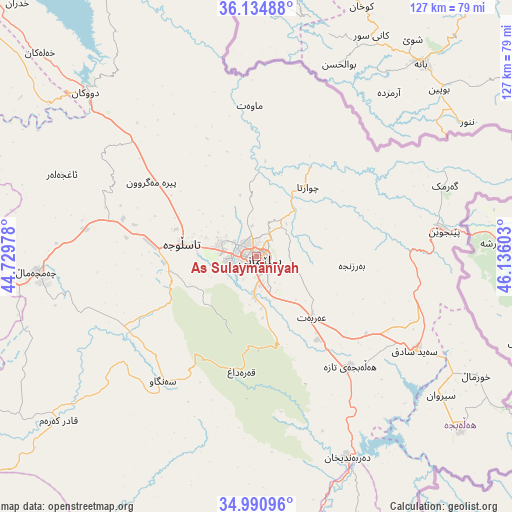
As Sulaymānīyah GPS coordinates[2]
35° 33' 53.856" North, 45° 25' 58.44" East
| Map corner | latitude | longitude |
|---|---|---|
| Upper-left | 36.13488°, | 44.72978° |
| Center: | 35.56496°, | 45.4329° |
| Lower-right: | 34.99096°, | 46.13603° |
| Map W x H: | 127.2×127.2 km | = 79×79mi |
| max Lat: | 37.22781° ⇑33.8% North |
| As Sulaymānīyah: | 35.56496° |
| min Lat: | ⇓66.2% South 29.97421° |
| min Long | As Sulaymānīy | max Long |
| 40.28586° | 45.4329° | 48.47309° |
| W 76.8%⇐ | ⇒23.2% E |
Elevation
Elevation of As Sulaymānīyah is 847 m = 2779 ft, and this is 554 m = 1818 ft above average elevation for this country.
| Max E: |
1316 m = 4318 ft | 11.3% |
| As Sulaymānīyah | 847 m 2779 ft | |
| Avg. | 293 m = 961 ft | |
Min E: |
1 m = 3 ft | 88.7% |
See also: As Sulaymānīyah elevation on elevation.city.
Geographical zone
As Sulaymānīyah is located in North temperate zone (between Tropic of Cancer and the Arctic Circle). Distance of this Northern Tropic circle is 1348.5 km =837.9 mi to South.| Distance of | km | miles | from As Sulaymānīyah |
|---|---|---|---|
| North Pole | 6052.6 | 3760.9 | to North |
| Arctic Circle | 3446.7 | 2141.7 | to North |
| Tropic Cancer | 1348.5 | 837.9 | to South |
| Equator | 3954.5 | 2457.2 | to South |


Nearby cities:
15 places around As Sulaymānīyah: (largest is in red/bold)
• Baynjiwayn
47.1 km =29.3 mi,  82°
82°
• Chwarta
21.4 km =13.3 mi,  35°
35°
• Derbendîxan
55.4 km =34.4 mi,  155°
155°
• Dukan
58.7 km =36.5 mi,  313°
313°
• Halshaw
73.3 km =45.5 mi,  347°
347°
• Hayraw
63.9 km =39.7 mi, 347°
• Jamjamāl
54.3 km =33.7 mi,  266°
266°
• Koysinceq
92.6 km =57.5 mi, 308°
• Mawet
37.4 km =23.2 mi,  357°
357°
• Qeredagh
28.9 km =18 mi,  187°
187°
• Qeładizê
73.9 km =45.9 mi,  338°
338°
• Seyid Sadiq
45.8 km =28.5 mi,  120°
120°
• Ḩalabjah
66.1 km =41.1 mi,  130°
130°
• Ḩalabjah al Jadīdah
35.8 km =22.2 mi,  139°
139°
• Ṟaniye
91.4 km =56.8 mi,  327°
327°
In other languages:
- In Spanish: Solimania
- In France: Souleimaniye
- In German: Sulaimaniyya
- In Russian: Сулеймания
Sources, notices
• [Note1] Compared only with cities in Iraq existing in our database
• [Src1] Map data: © OpenStreetMap contributors (CC-BY-SA)
• [Src2] Other city data from geonames.org with taken over terms of usage.
• [Src3] Geographical zone / Annual Mean Temperature by Robert A. Rohde @ Wikipedia
