Baynjiwayn geodata
Baynjiwayn (Sulaymaniyah) is a seat of a second-order administrative division; located in Iraq in Asia/Baghdad (GMT+3) time zone. With population of 27,116 people, there are 56 cities with bigger population in this country. Compared to other cities in Iraq, 67.6% of cities are located further ↓South; 82.4% of cities are located further ←West and 97.9% of cities have lower elevation than Baynjiwayn. Note1


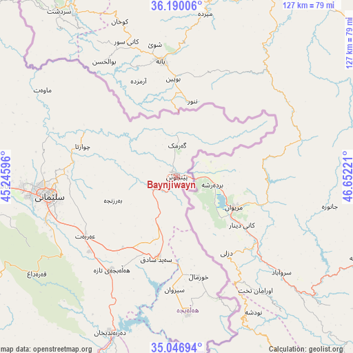
Baynjiwayn GPS coordinates[2]
35° 37' 13.944" North, 45° 56' 56.688" East
| Map corner | latitude | longitude |
|---|---|---|
| Upper-left | 36.19006°, | 45.24596° |
| Center: | 35.62054°, | 45.94908° |
| Lower-right: | 35.04694°, | 46.65221° |
| Map W x H: | 127.1×127.1 km | = 79×79mi |
| max Lat: | 37.22781° ⇑32.4% North |
| Baynjiwayn: | 35.62054° |
| min Lat: | ⇓67.6% South 29.97421° |
| min Long | Baynjiwayn | max Long |
| 40.28586° | 45.94908° | 48.47309° |
| W 82.4%⇐ | ⇒17.6% E |
Elevation
Elevation of Baynjiwayn is 1256 m = 4121 ft, and this is 963 m = 3159 ft above average elevation for this country.
| Max E: |
1316 m = 4318 ft | 2.1% |
| Baynjiwayn | 1256 m 4121 ft | |
| Avg. | 293 m = 961 ft | |
Min E: |
1 m = 3 ft | 97.9% |
See also: Iraq elevation on elevation.city.
Geographical zone
Baynjiwayn is located in North temperate zone (between Tropic of Cancer and the Arctic Circle). Distance of this Northern Tropic circle is 1354.7 km =841.8 mi to South.| Distance of | km | miles | from Baynjiwayn |
|---|---|---|---|
| North Pole | 6046.4 | 3757.1 | to North |
| Arctic Circle | 3440.5 | 2137.8 | to North |
| Tropic Cancer | 1354.7 | 841.8 | to South |
| Equator | 3960.6 | 2461 | to South |


Nearby cities:
15 places around Baynjiwayn: (largest is in red/bold)
• As Sulaymānīyah
47.1 km =29.3 mi,  262°
262°
• Chwarta
35.9 km =22.3 mi,  288°
288°
• Derbendîxan
61.3 km =38.1 mi,  202°
202°
• Dukan
95.4 km =59.3 mi, 291°
• Halshaw
90.2 km =56 mi,  316°
316°
• Hayraw
82.3 km =51.1 mi,  313°
313°
• Jamjamāl
101.3 km =62.9 mi, 264°
• Kelar
124.4 km =77.3 mi,  207°
207°
• Mawet
57.5 km =35.7 mi,  302°
302°
• Qeredagh
61.4 km =38.2 mi,  235°
235°
• Qeładizê
96.7 km =60.1 mi, 310°
• Seyid Sadiq
30.7 km =19.1 mi,  194°
194°
• Ḩalabjah
49.3 km =30.6 mi,  176°
176°
• Ḩalabjah al Jadīdah
40.9 km =25.4 mi,  215°
215°
• Ṟaniye
119.2 km =74.1 mi, 306°
Sources, notices
• [Note1] Compared only with cities in Iraq existing in our database
• [Src1] Map data: © OpenStreetMap contributors (CC-BY-SA)
• [Src2] Other city data from geonames.org with taken over terms of usage.
• [Src3] Geographical zone / Annual Mean Temperature by Robert A. Rohde @ Wikipedia
