Hayraw geodata
Hayraw (Sulaymaniyah) is a seat of a third-order administrative division; located in Iraq in Asia/Baghdad (GMT+3) time zone. In our database, there are 71 cities with bigger population. Compared to other cities in Iraq, 75.4% of cities are located further ↓South; 71.8% of cities are located further ←West and 98.6% of cities have lower elevation than Hayraw. Note1


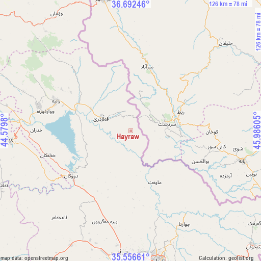
Hayraw GPS coordinates[2]
36° 7' 35.724" North, 45° 16' 58.512" East
| Map corner | latitude | longitude |
|---|---|---|
| Upper-left | 36.69246°, | 44.5798° |
| Center: | 36.12659°, | 45.28292° |
| Lower-right: | 35.55661°, | 45.98605° |
| Map W x H: | 126.3×126.3 km | = 78.5×78.5mi |
| max Lat: | 37.22781° ⇑24.6% North |
| Hayraw: | 36.12659° |
| min Lat: | ⇓75.4% South 29.97421° |
| min Long | Hayraw | max Long |
| 40.28586° | 45.28292° | 48.47309° |
| W 71.8%⇐ | ⇒28.2% E |
Elevation
Elevation of Hayraw is 1264 m = 4147 ft, and this is 971 m = 3186 ft above average elevation for this country.
| Max E: |
1316 m = 4318 ft | 1.4% |
| Hayraw | 1264 m 4147 ft | |
| Avg. | 293 m = 961 ft | |
Min E: |
1 m = 3 ft | 98.6% |
See also: Iraq elevation on elevation.city.
Geographical zone
Hayraw is located in North temperate zone (between Tropic of Cancer and the Arctic Circle). Distance of this Northern Tropic circle is 1411 km =876.8 mi to South.| Distance of | km | miles | from Hayraw |
|---|---|---|---|
| North Pole | 5990.2 | 3722.1 | to North |
| Arctic Circle | 3384.3 | 2102.9 | to North |
| Tropic Cancer | 1411 | 876.8 | to South |
| Equator | 4016.9 | 2496 | to South |


Nearby cities:
15 places around Hayraw: (largest is in red/bold)
• As Sulaymānīyah
63.9 km =39.7 mi,  167°
167°
• Baynjiwayn
82.3 km =51.1 mi,  133°
133°
• Choman
66.8 km =41.5 mi,  328°
328°
• Chwarta
52.1 km =32.4 mi,  150°
150°
• Dukan
36.2 km =22.5 mi,  232°
232°
• Halshaw
9.4 km =5.8 mi,  346°
346°
• Hīrān
72.8 km =45.2 mi,  283°
283°
• Jamjamāl
77.4 km =48.1 mi,  211°
211°
• Koysinceq
59 km =36.7 mi,  265°
265°
• Mawet
27.7 km =17.2 mi, 154°
• Nāḩiyat Hīrān
73.3 km =45.5 mi, 283°
• Qeładizê
15.1 km =9.4 mi,  294°
294°
• Ruwāndiz
86.8 km =53.9 mi,  308°
308°
• Soran
88.3 km =54.9 mi, 311°
• Ṟaniye
38.7 km =24 mi, 291°
Sources, notices
• [Note1] Compared only with cities in Iraq existing in our database
• [Src1] Map data: © OpenStreetMap contributors (CC-BY-SA)
• [Src2] Other city data from geonames.org with taken over terms of usage.
• [Src3] Geographical zone / Annual Mean Temperature by Robert A. Rohde @ Wikipedia
