Sirjan geodata
Sirjan (Kerman) is a populated place; located in Iran in Asia/Tehran (GMT+3.5) time zone. With population of 207,645 people, there are 37 cities with bigger population in this country. Compared to other cities in Iran, 85.5% of cities are located further ↑North; 79.4% of cities are located further ←West and 83.4% of cities have lower elevation than Sirjan. Note1


Sirjan GPS coordinates[2]
29° 27' 4.932" North, 55° 40' 51.24" East
| Map corner | latitude | longitude |
|---|---|---|
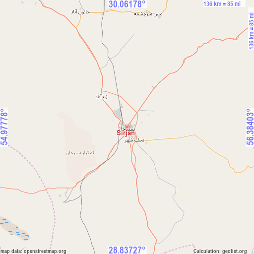
| Upper-left | 30.06178°, | 54.97778° |
| Center: | 29.45137°, | 55.6809° |
| Lower-right: | 28.83727°, | 56.38403° |
| Map W x H: | 136.2×136.2 km | = 84.6×84.6mi |
| max Lat: | 39.6482° ⇑85.5% North |
| Sirjan: | 29.45137° |
| min Lat: | ⇓14.5% South 25.2919° |
| min Long | Sirjan | max Long |
| 44.38416° | 55.6809° | 61.9965° |
| W 79.4%⇐ | ⇒20.6% E |
Elevation
Elevation of Sirjan is 1744 m = 5722 ft, and this is 695 m = 2280 ft above average elevation for this country.
| Max E: |
2564 m = 8412 ft | 16.6% |
| Sirjan | 1744 m 5722 ft | |
| Avg. | 1049 m = 3442 ft | |
Min E: |
-24 m = -79 ft | 83.4% |
See also: Sirjan elevation on elevation.city.
Geographical zone
Sirjan is located in North temperate zone (between Tropic of Cancer and the Arctic Circle). Distance of this Northern Tropic circle is 668.8 km =415.6 mi to South.| Distance of | km | miles | from Sirjan |
|---|---|---|---|
| North Pole | 6732.4 | 4183.3 | to North |
| Arctic Circle | 4126.5 | 2564.1 | to North |
| Tropic Cancer | 668.8 | 415.6 | to South |
| Equator | 3274.7 | 2034.8 | to South |


Nearby cities:
15 places around Sirjan: (largest is in red/bold)
• Anār
162.7 km =101.1 mi,  345°
345°
• Arzū’īyeh
130.9 km =81.3 mi,  149°
149°
• Bardsīr
101 km =62.8 mi,  58°
58°
• Bāft
92.5 km =57.5 mi,  105°
105°
• Dārāb
135 km =83.9 mi,  234°
234°
• Estahbān
163 km =101.3 mi,  257°
257°
• Kerman
163.5 km =101.6 mi, 55°
• Kūh Sefīd
110.3 km =68.5 mi,  100°
100°
• Neyrīz
134.1 km =83.3 mi, 257°
• Rafsanjān
110.4 km =68.6 mi,  15°
15°
• Rābor
120.7 km =75 mi, 98°
• Shahr-e Bābak
91.7 km =57 mi,  323°
323°
• Shahr-e Herāt
142.9 km =88.8 mi,  297°
297°
• Ḩājjīābād
128.8 km =80 mi,  170°
170°
• Ḩājjīābād
172.6 km =107.2 mi, 225°
Sources, notices
• [Note1] Compared only with cities in Iran existing in our database
• [Src1] Map data: © OpenStreetMap contributors (CC-BY-SA)
• [Src2] Other city data from geonames.org with taken over terms of usage.
• [Src3] Geographical zone / Annual Mean Temperature by Robert A. Rohde @ Wikipedia
