Shahr-e Bābak geodata
Shahr-e Bābak (Kerman) is a seat of a second-order administrative division; located in Iran in Asia/Tehran (GMT+3.5) time zone. With population of 52,409 people, there are 121 cities with bigger population in this country. Compared to other cities in Iran, 82.3% of cities are located further ↑North; 76.9% of cities are located further ←West and 89.6% of cities have lower elevation than Shahr-e Bābak. Note1


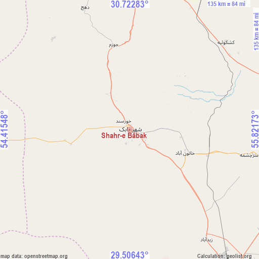
Shahr-e Bābak GPS coordinates[2]
30° 6' 59.4" North, 55° 7' 6.96" East
| Map corner | latitude | longitude |
|---|---|---|
| Upper-left | 30.72283°, | 54.41548° |
| Center: | 30.1165°, | 55.1186° |
| Lower-right: | 29.50643°, | 55.82173° |
| Map W x H: | 135.3×135.3 km | = 84.1×84.1mi |
| max Lat: | 39.6482° ⇑82.3% North |
| Shahr-e Bābak: | 30.1165° |
| min Lat: | ⇓17.7% South 25.2919° |
| min Long | Shahr-e Bābak | max Long |
| 44.38416° | 55.1186° | 61.9965° |
| W 76.9%⇐ | ⇒23.1% E |
Elevation
Elevation of Shahr-e Bābak is 1846 m = 6056 ft, and this is 797 m = 2615 ft above average elevation for this country.
| Max E: |
2564 m = 8412 ft | 10.4% |
| Shahr-e Bābak | 1846 m 6056 ft | |
| Avg. | 1049 m = 3442 ft | |
Min E: |
-24 m = -79 ft | 89.6% |
See also: Shahr-e Bābak elevation on elevation.city.
Geographical zone
Shahr-e Bābak is located in North temperate zone (between Tropic of Cancer and the Arctic Circle). Distance of this Northern Tropic circle is 742.7 km =461.5 mi to South.| Distance of | km | miles | from Shahr-e Bābak |
|---|---|---|---|
| North Pole | 6658.4 | 4137.3 | to North |
| Arctic Circle | 4052.5 | 2518.1 | to North |
| Tropic Cancer | 742.7 | 461.5 | to South |
| Equator | 3348.6 | 2080.7 | to South |


Nearby cities:
15 places around Shahr-e Bābak: (largest is in red/bold)
• Anār
85.1 km =52.9 mi,  9°
9°
• Arsanjān
175.7 km =109.2 mi,  262°
262°
• Bardsīr
141.8 km =88.1 mi,  98°
98°
• Bāfq
167.5 km =104.1 mi, 9°
• Bāft
173.8 km =108 mi,  124°
124°
• Dārāb
161.6 km =100.4 mi,  200°
200°
• Estahbān
151.5 km =94.1 mi,  223°
223°
• Mahrīz
175.5 km =109.1 mi,  338°
338°
• Neyrīz
127.5 km =79.2 mi, 216°
• Rafsanjān
90 km =55.9 mi,  69°
69°
• Shahr-e Herāt
72.1 km =44.8 mi, 264°
• Shahrak-e Pābedānā
166.7 km =103.6 mi,  47°
47°
• Sirjan
91.7 km =57 mi,  143°
143°
• Sūrīān
145.9 km =90.7 mi,  284°
284°
• Zarand
158.7 km =98.6 mi,  60°
60°
Sources, notices
• [Note1] Compared only with cities in Iran existing in our database
• [Src1] Map data: © OpenStreetMap contributors (CC-BY-SA)
• [Src2] Other city data from geonames.org with taken over terms of usage.
• [Src3] Geographical zone / Annual Mean Temperature by Robert A. Rohde @ Wikipedia
