Mohr geodata
Mohr (Fars) is a seat of a second-order administrative division; located in Iran in Asia/Tehran (GMT+3.5) time zone. With population of 35,000 people, there are 165 cities with bigger population in this country. Compared to other cities in Iran, 94.3% of cities are located further ↑North; 64.4% of cities are located further ←West and 74.6% of cities have higher elevation than Mohr. Note1


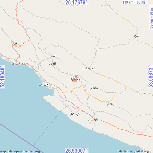
Mohr GPS coordinates[2]
27° 33' 18.72" North, 52° 53' 0.96" East
| Map corner | latitude | longitude |
|---|---|---|
| Upper-left | 28.17679°, | 52.18048° |
| Center: | 27.5552°, | 52.8836° |
| Lower-right: | 26.93007°, | 53.58673° |
| Map W x H: | 138.6×138.6 km | = 86.1×86.1mi |
| max Lat: | 39.6482° ⇑94.3% North |
| Mohr: | 27.5552° |
| min Lat: | ⇓5.7% South 25.2919° |
| min Long | Mohr | max Long |
| 44.38416° | 52.8836° | 61.9965° |
| W 64.4%⇐ | ⇒35.6% E |
Elevation
Elevation of Mohr is 439 m = 1440 ft, and this is 610 m = 2001 ft below average elevation for this country.
| Max E: |
2564 m = 8412 ft | 74.6% |
| Avg. | 1049 m = 3442 ft | |
| Mohr | 439 m = 1440 ft | |
Min E: |
-24 m = -79 ft | 25.4% |
See also: Iran elevation on elevation.city.
Geographical zone
Mohr is located in North temperate zone (between Tropic of Cancer and the Arctic Circle). Distance of this Northern Tropic circle is 457.9 km =284.5 mi to South.| Distance of | km | miles | from Mohr |
|---|---|---|---|
| North Pole | 6943.2 | 4314.3 | to North |
| Arctic Circle | 4337.3 | 2695.1 | to North |
| Tropic Cancer | 457.9 | 284.5 | to South |
| Equator | 3063.9 | 1903.8 | to South |


Nearby cities:
15 places around Mohr: (largest is in red/bold)
• Bandar-e ‘Asalūyeh
28.6 km =17.8 mi,  252°
252°
• Bastak
151.7 km =94.3 mi,  105°
105°
• Deyr
98.3 km =61.1 mi,  288°
288°
• Farāshband
165.6 km =102.9 mi,  332°
332°
• Fīrūzābād
146.5 km =91 mi,  347°
347°
• Gerāsh
124 km =77.1 mi,  84°
84°
• Gāvbandī
41.4 km =25.7 mi,  158°
158°
• Jahrom
124.3 km =77.2 mi,  32°
32°
• Jam
62.8 km =39 mi,  298°
298°
• Kangān
86.6 km =53.8 mi, 290°
• Khonj
65.8 km =40.9 mi,  55°
55°
• Kīsh
158 km =98.2 mi,  134°
134°
• Lamerd
38.1 km =23.7 mi, 130°
• Qīr
104.2 km =64.7 mi,  8°
8°
• Shahr-e Qadīm-e Lār
144.4 km =89.7 mi, 84°
Sources, notices
• [Note1] Compared only with cities in Iran existing in our database
• [Src1] Map data: © OpenStreetMap contributors (CC-BY-SA)
• [Src2] Other city data from geonames.org with taken over terms of usage.
• [Src3] Geographical zone / Annual Mean Temperature by Robert A. Rohde @ Wikipedia
