Khonj geodata
Khonj (Fars) is a seat of a second-order administrative division; located in Iran in Asia/Tehran (GMT+3.5) time zone. In our database, there are 232 cities with bigger population. Compared to other cities in Iran, 93% of cities are located further ↑North; 69.2% of cities are located further ←West and 69.8% of cities have higher elevation than Khonj. Note1


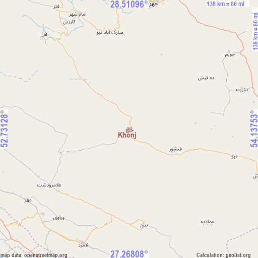
Khonj GPS coordinates[2]
27° 53' 28.68" North, 53° 26' 3.84" East
| Map corner | latitude | longitude |
|---|---|---|
| Upper-left | 28.51096°, | 52.73128° |
| Center: | 27.8913°, | 53.4344° |
| Lower-right: | 27.26808°, | 54.13753° |
| Map W x H: | 138.2×138.2 km | = 85.9×85.9mi |
| max Lat: | 39.6482° ⇑93% North |
| Khonj: | 27.8913° |
| min Lat: | ⇓7% South 25.2919° |
| min Long | Khonj | max Long |
| 44.38416° | 53.4344° | 61.9965° |
| W 69.2%⇐ | ⇒30.8% E |
Elevation
Elevation of Khonj is 671 m = 2201 ft, and this is 378 m = 1240 ft below average elevation for this country.
| Max E: |
2564 m = 8412 ft | 69.8% |
| Avg. | 1049 m = 3442 ft | |
| Khonj | 671 m = 2201 ft | |
Min E: |
-24 m = -79 ft | 30.2% |
See also: Iran elevation on elevation.city.
Geographical zone
Khonj is located in North temperate zone (between Tropic of Cancer and the Arctic Circle). Distance of this Northern Tropic circle is 495.3 km =307.8 mi to South.| Distance of | km | miles | from Khonj |
|---|---|---|---|
| North Pole | 6905.8 | 4291.1 | to North |
| Arctic Circle | 4300 | 2671.9 | to North |
| Tropic Cancer | 495.3 | 307.8 | to South |
| Equator | 3101.2 | 1927 | to South |


Nearby cities:
15 places around Khonj: (largest is in red/bold)
• Bandar-e ‘Asalūyeh
93.6 km =58.2 mi,  240°
240°
• Bastak
119.9 km =74.5 mi,  129°
129°
• Dārāb
144.8 km =90 mi,  48°
48°
• Fasā
118.3 km =73.5 mi,  10°
10°
• Fīrūzābād
135.5 km =84.2 mi,  321°
321°
• Gerāsh
73.3 km =45.5 mi,  109°
109°
• Gāvbandī
85.5 km =53.1 mi,  207°
207°
• Jahrom
68.8 km =42.8 mi, 10°
• Jam
109.2 km =67.9 mi,  266°
266°
• Kangān
135 km =83.9 mi, 267°
• Lamerd
66.9 km =41.6 mi,  202°
202°
• Mohr
65.8 km =40.9 mi, 235°
• Qīr
76.5 km =47.5 mi,  329°
329°
• Shahr-e Qadīm-e Lār
92.2 km =57.3 mi,  104°
104°
• Ḩājjīābād
110 km =68.4 mi,  61°
61°
Sources, notices
• [Note1] Compared only with cities in Iran existing in our database
• [Src1] Map data: © OpenStreetMap contributors (CC-BY-SA)
• [Src2] Other city data from geonames.org with taken over terms of usage.
• [Src3] Geographical zone / Annual Mean Temperature by Robert A. Rohde @ Wikipedia
