Kīsh geodata
Kīsh (Hormozgan) is a populated place; located in Iran in Asia/Tehran (GMT+3.5) time zone. With population of 20,922 people, there are 192 cities with bigger population in this country. Compared to other cities in Iran, 98.4% of cities are located further ↑North; 71.4% of cities are located further ←West and 93.9% of cities have higher elevation than Kīsh. Note1


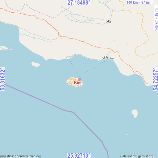
Kīsh GPS coordinates[2]
26° 33' 28.008" North, 54° 1' 9.984" East
| Map corner | latitude | longitude |
|---|---|---|
| Upper-left | 27.18498°, | 53.31632° |
| Center: | 26.55778°, | 54.01944° |
| Lower-right: | 25.92713°, | 54.72257° |
| Map W x H: | 139.9×139.9 km | = 86.9×86.9mi |
| max Lat: | 39.6482° ⇑98.4% North |
| Kīsh: | 26.55778° |
| min Lat: | ⇓1.6% South 25.2919° |
| min Long | Kīsh | max Long |
| 44.38416° | 54.01944° | 61.9965° |
| W 71.4%⇐ | ⇒28.6% E |
Elevation
Elevation of Kīsh is 6 m = 20 ft, and this is 1043 m = 3422 ft below average elevation for this country.
| Max E: |
2564 m = 8412 ft | 93.9% |
| Avg. | 1049 m = 3442 ft | |
| Kīsh | 6 m = 20 ft | |
Min E: |
-24 m = -79 ft | 6.1% |
See also: Iran elevation on elevation.city.
Geographical zone
Kīsh is located in North temperate zone (between Tropic of Cancer and the Arctic Circle). Distance of this Northern Tropic circle is 347 km =215.6 mi to South.| Distance of | km | miles | from Kīsh |
|---|---|---|---|
| North Pole | 7054.1 | 4383.2 | to North |
| Arctic Circle | 4448.2 | 2764 | to North |
| Tropic Cancer | 347 | 215.6 | to South |
| Equator | 2952.9 | 1834.8 | to South |


Nearby cities:
15 places around Kīsh: (largest is in red/bold)
• Bandar Abbas
234.9 km =146 mi,  72°
72°
• Bandar-e Khamīr
161.5 km =100.4 mi, 74°
• Bandar-e Lengeh
85.7 km =53.3 mi,  89°
89°
• Bandar-e ‘Asalūyeh
173.2 km =107.6 mi,  306°
306°
• Bastak
79.2 km =49.2 mi,  25°
25°
• Gerāsh
124.2 km =77.2 mi,  5°
5°
• Gāvbandī
121.4 km =75.4 mi, 306°
• Jahrom
220.6 km =137.1 mi,  348°
348°
• Jam
219.1 km =136.1 mi, 310°
• Khonj
159.2 km =98.9 mi,  338°
338°
• Lamerd
120 km =74.6 mi,  316°
316°
• Mohr
158 km =98.2 mi, 314°
• Qeshm
227.6 km =141.4 mi,  78°
78°
• Shahr-e Qadīm-e Lār
129.2 km =80.3 mi, 14°
• Ḩājjīābād
204 km =126.8 mi, 11°
Sources, notices
• [Note1] Compared only with cities in Iran existing in our database
• [Src1] Map data: © OpenStreetMap contributors (CC-BY-SA)
• [Src2] Other city data from geonames.org with taken over terms of usage.
• [Src3] Geographical zone / Annual Mean Temperature by Robert A. Rohde @ Wikipedia
