Lamerd geodata
Lamerd (Fars) is a seat of a second-order administrative division; located in Iran in Asia/Tehran (GMT+3.5) time zone. In our database, there are 232 cities with bigger population. Compared to other cities in Iran, 95.7% of cities are located further ↑North; 66.4% of cities are located further ←West and 74.8% of cities have higher elevation than Lamerd. Note1


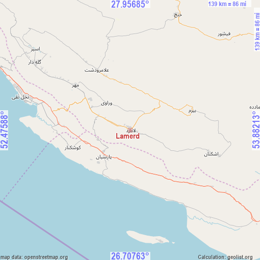
Lamerd GPS coordinates[2]
27° 20' 2.4" North, 53° 10' 44.4" East
| Map corner | latitude | longitude |
|---|---|---|
| Upper-left | 27.95685°, | 52.47588° |
| Center: | 27.334°, | 53.179° |
| Lower-right: | 26.70763°, | 53.88213° |
| Map W x H: | 138.9×138.9 km | = 86.3×86.3mi |
| max Lat: | 39.6482° ⇑95.7% North |
| Lamerd: | 27.334° |
| min Lat: | ⇓4.3% South 25.2919° |
| min Long | Lamerd | max Long |
| 44.38416° | 53.179° | 61.9965° |
| W 66.4%⇐ | ⇒33.6% E |
Elevation
Elevation of Lamerd is 425 m = 1394 ft, and this is 624 m = 2047 ft below average elevation for this country.
| Max E: |
2564 m = 8412 ft | 74.8% |
| Avg. | 1049 m = 3442 ft | |
| Lamerd | 425 m = 1394 ft | |
Min E: |
-24 m = -79 ft | 25.2% |
See also: Iran elevation on elevation.city.
Geographical zone
Lamerd is located in North temperate zone (between Tropic of Cancer and the Arctic Circle). Distance of this Northern Tropic circle is 433.3 km =269.2 mi to South.| Distance of | km | miles | from Lamerd |
|---|---|---|---|
| North Pole | 6967.8 | 4329.6 | to North |
| Arctic Circle | 4361.9 | 2710.4 | to North |
| Tropic Cancer | 433.3 | 269.2 | to South |
| Equator | 3039.3 | 1888.5 | to South |


Nearby cities:
15 places around Lamerd: (largest is in red/bold)
• Bandar-e ‘Asalūyeh
58.6 km =36.4 mi,  285°
285°
• Bastak
118.3 km =73.5 mi,  97°
97°
• Deyr
134.6 km =83.6 mi, 294°
• Fīrūzābād
178.2 km =110.7 mi,  340°
340°
• Gerāsh
101.5 km =63.1 mi,  68°
68°
• Gāvbandī
19.9 km =12.4 mi,  225°
225°
• Jahrom
135 km =83.9 mi,  16°
16°
• Jam
100.5 km =62.4 mi,  303°
303°
• Kangān
123.3 km =76.6 mi, 296°
• Khonj
66.9 km =41.6 mi, 22°
• Kīsh
120 km =74.6 mi,  136°
136°
• Mohr
38.1 km =23.7 mi,  310°
310°
• Qīr
128.5 km =79.8 mi,  353°
353°
• Shahr-e Qadīm-e Lār
121.1 km =75.2 mi, 71°
• Ḩājjīābād
167.1 km =103.8 mi,  47°
47°
Sources, notices
• [Note1] Compared only with cities in Iran existing in our database
• [Src1] Map data: © OpenStreetMap contributors (CC-BY-SA)
• [Src2] Other city data from geonames.org with taken over terms of usage.
• [Src3] Geographical zone / Annual Mean Temperature by Robert A. Rohde @ Wikipedia
