Deyr geodata
Deyr (Bushehr) is a seat of a second-order administrative division; located in Iran in Asia/Tehran (GMT+3.5) time zone. In our database, there are 232 cities with bigger population. Compared to other cities in Iran, 93.2% of cities are located further ↑North; 58.5% of cities are located further ←West and 92.3% of cities have higher elevation than Deyr. Note1


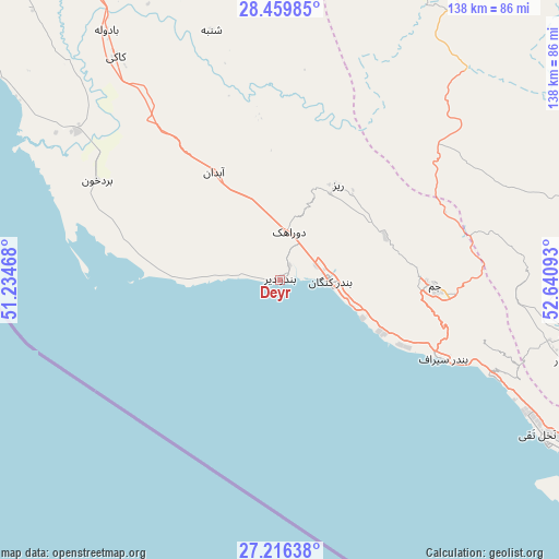
Deyr GPS coordinates[2]
27° 50' 23.64" North, 51° 56' 16.08" East
| Map corner | latitude | longitude |
|---|---|---|
| Upper-left | 28.45985°, | 51.23468° |
| Center: | 27.8399°, | 51.9378° |
| Lower-right: | 27.21638°, | 52.64093° |
| Map W x H: | 138.3×138.3 km | = 85.9×85.9mi |
| max Lat: | 39.6482° ⇑93.2% North |
| Deyr: | 27.8399° |
| min Lat: | ⇓6.8% South 25.2919° |
| min Long | Deyr | max Long |
| 44.38416° | 51.9378° | 61.9965° |
| W 58.5%⇐ | ⇒41.5% E |
Elevation
Elevation of Deyr is 9 m = 30 ft, and this is 1040 m = 3412 ft below average elevation for this country.
| Max E: |
2564 m = 8412 ft | 92.3% |
| Avg. | 1049 m = 3442 ft | |
| Deyr | 9 m = 30 ft | |
Min E: |
-24 m = -79 ft | 7.7% |
See also: Iran elevation on elevation.city.
Geographical zone
Deyr is located in North temperate zone (between Tropic of Cancer and the Arctic Circle). Distance of this Northern Tropic circle is 489.6 km =304.2 mi to South.| Distance of | km | miles | from Deyr |
|---|---|---|---|
| North Pole | 6911.6 | 4294.7 | to North |
| Arctic Circle | 4305.7 | 2675.4 | to North |
| Tropic Cancer | 489.6 | 304.2 | to South |
| Equator | 3095.5 | 1923.5 | to South |


Nearby cities:
15 places around Deyr: (largest is in red/bold)
• Ahram
132.9 km =82.6 mi,  330°
330°
• Bandar-e ‘Asalūyeh
77.4 km =48.1 mi,  121°
121°
• Borāzjān
173.8 km =108 mi,  336°
336°
• Bushehr
165.4 km =102.8 mi,  319°
319°
• Farāshband
115.7 km =71.9 mi,  7°
7°
• Fīrūzābād
127.7 km =79.3 mi,  29°
29°
• Gāvbandī
129.1 km =80.2 mi, 122°
• Jam
38.1 km =23.7 mi,  91°
91°
• Kangān
12.3 km =7.6 mi, 93°
• Kavār
168.6 km =104.8 mi, 25°
• Khonj
147.2 km =91.5 mi, 87°
• Khowrmūj
105.8 km =65.7 mi, 328°
• Lamerd
134.6 km =83.6 mi,  114°
114°
• Mohr
98.3 km =61.1 mi, 108°
• Qīr
129.1 km =80.2 mi,  56°
56°
Sources, notices
• [Note1] Compared only with cities in Iran existing in our database
• [Src1] Map data: © OpenStreetMap contributors (CC-BY-SA)
• [Src2] Other city data from geonames.org with taken over terms of usage.
• [Src3] Geographical zone / Annual Mean Temperature by Robert A. Rohde @ Wikipedia
