Bandar-e ‘Asalūyeh geodata
Bandar-e ‘Asalūyeh (Bushehr) is a seat of a second-order administrative division; located in Iran in Asia/Tehran (GMT+3.5) time zone. In our database, there are 232 cities with bigger population. Compared to other cities in Iran, 95% of cities are located further ↑North; 62.4% of cities are located further ←West and 95% of cities have higher elevation than Bandar-e ‘Asalūyeh. Note1


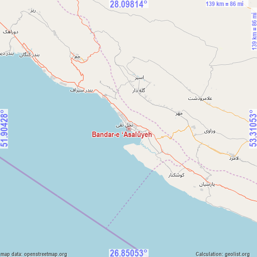
Bandar-e ‘Asalūyeh GPS coordinates[2]
27° 28' 33.96" North, 52° 36' 26.64" East
| Map corner | latitude | longitude |
|---|---|---|
| Upper-left | 28.09814°, | 51.90428° |
| Center: | 27.4761°, | 52.6074° |
| Lower-right: | 26.85053°, | 53.31053° |
| Map W x H: | 138.7×138.7 km | = 86.2×86.2mi |
| max Lat: | 39.6482° ⇑95% North |
| Bandar-e ‘Asalūyeh: | 27.4761° |
| min Lat: | ⇓5% South 25.2919° |
| min Long | Bandar-e ‘Asa | max Long |
| 44.38416° | 52.6074° | 61.9965° |
| W 62.4%⇐ | ⇒37.6% E |
Elevation
Elevation of Bandar-e ‘Asalūyeh is 4 m = 13 ft, and this is 1045 m = 3428 ft below average elevation for this country.
| Max E: |
2564 m = 8412 ft | 95% |
| Avg. | 1049 m = 3442 ft | |
| Bandar-e ‘Asalūyeh | 4 m = 13 ft | |
Min E: |
-24 m = -79 ft | 5% |
See also: Iran elevation on elevation.city.
Geographical zone
Bandar-e ‘Asalūyeh is located in North temperate zone (between Tropic of Cancer and the Arctic Circle). Distance of this Northern Tropic circle is 449.1 km =279.1 mi to South.| Distance of | km | miles | from Bandar-e ‘Asalūyeh |
|---|---|---|---|
| North Pole | 6952 | 4319.8 | to North |
| Arctic Circle | 4346.1 | 2700.5 | to North |
| Tropic Cancer | 449.1 | 279.1 | to South |
| Equator | 3055.1 | 1898.4 | to South |


Nearby cities:
15 places around Bandar-e ‘Asalūyeh: (largest is in red/bold)
• Bastak
176.5 km =109.7 mi,  100°
100°
• Deyr
77.4 km =48.1 mi,  301°
301°
• Farāshband
163.2 km =101.4 mi,  341°
341°
• Fīrūzābād
152.1 km =94.5 mi,  358°
358°
• Gerāsh
152.2 km =94.6 mi,  81°
81°
• Gāvbandī
51.8 km =32.2 mi,  125°
125°
• Jahrom
147.4 km =91.6 mi,  39°
39°
• Jam
48 km =29.8 mi,  324°
324°
• Kangān
66.8 km =41.5 mi,  306°
306°
• Khonj
93.6 km =58.2 mi,  60°
60°
• Kīsh
173.2 km =107.6 mi, 126°
• Lamerd
58.6 km =36.4 mi,  105°
105°
• Mohr
28.6 km =17.8 mi,  72°
72°
• Qīr
119.5 km =74.3 mi,  20°
20°
• Shahr-e Qadīm-e Lār
172.5 km =107.2 mi, 82°
Sources, notices
• [Note1] Compared only with cities in Iran existing in our database
• [Src1] Map data: © OpenStreetMap contributors (CC-BY-SA)
• [Src2] Other city data from geonames.org with taken over terms of usage.
• [Src3] Geographical zone / Annual Mean Temperature by Robert A. Rohde @ Wikipedia
