Bandar-e Khamīr geodata
Bandar-e Khamīr (Hormozgan) is a seat of a second-order administrative division; located in Iran in Asia/Tehran (GMT+3.5) time zone. In our database, there are 232 cities with bigger population. Compared to other cities in Iran, 97.5% of cities are located further ↑North; 79.1% of cities are located further ←West and 89.6% of cities have higher elevation than Bandar-e Khamīr. Note1


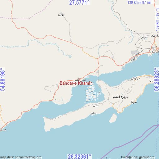
Bandar-e Khamīr GPS coordinates[2]
26° 57' 7.56" North, 55° 35' 6.36" East
| Map corner | latitude | longitude |
|---|---|---|
| Upper-left | 27.5771°, | 54.88198° |
| Center: | 26.9521°, | 55.5851° |
| Lower-right: | 26.32361°, | 56.28823° |
| Map W x H: | 139.4×139.4 km | = 86.6×86.6mi |
| max Lat: | 39.6482° ⇑97.5% North |
| Bandar-e Khamīr: | 26.9521° |
| min Lat: | ⇓2.5% South 25.2919° |
| min Long | Bandar-e Khamī | max Long |
| 44.38416° | 55.5851° | 61.9965° |
| W 79.1%⇐ | ⇒20.9% E |
Elevation
Elevation of Bandar-e Khamīr is 16 m = 52 ft, and this is 1033 m = 3389 ft below average elevation for this country.
| Max E: |
2564 m = 8412 ft | 89.6% |
| Avg. | 1049 m = 3442 ft | |
| Bandar-e Khamīr | 16 m = 52 ft | |
Min E: |
-24 m = -79 ft | 10.4% |
See also: Iran elevation on elevation.city.
Geographical zone
Bandar-e Khamīr is located in North temperate zone (between Tropic of Cancer and the Arctic Circle). Distance of this Northern Tropic circle is 390.9 km =242.9 mi to South.| Distance of | km | miles | from Bandar-e Khamīr |
|---|---|---|---|
| North Pole | 7010.3 | 4356 | to North |
| Arctic Circle | 4404.4 | 2736.8 | to North |
| Tropic Cancer | 390.9 | 242.9 | to South |
| Equator | 2996.8 | 1862.1 | to South |


Nearby cities:
15 places around Bandar-e Khamīr: (largest is in red/bold)
• Arzū’īyeh
182.9 km =113.6 mi,  25°
25°
• Bandar Abbas
73.6 km =45.7 mi,  69°
69°
• Bandar-e Lengeh
82.5 km =51.3 mi,  237°
237°
• Bastak
123.7 km =76.9 mi,  282°
282°
• Dārāb
224.8 km =139.7 mi,  332°
332°
• Fāryāb
206.4 km =128.3 mi,  51°
51°
• Gerāsh
163.9 km =101.8 mi,  299°
299°
• Kīsh
161.5 km =100.4 mi,  254°
254°
• Manūjān
196.2 km =121.9 mi,  75°
75°
• Mīnāb
150.1 km =93.3 mi, 82°
• Qeshm
67.8 km =42.1 mi,  90°
90°
• Rūdān
168 km =104.4 mi, 71°
• Shahr-e Qadīm-e Lār
147.3 km =91.5 mi, 303°
• Ḩājjīābād
154.1 km =95.8 mi,  11°
11°
• Ḩājjīābād
193.7 km =120.4 mi,  323°
323°
Sources, notices
• [Note1] Compared only with cities in Iran existing in our database
• [Src1] Map data: © OpenStreetMap contributors (CC-BY-SA)
• [Src2] Other city data from geonames.org with taken over terms of usage.
• [Src3] Geographical zone / Annual Mean Temperature by Robert A. Rohde @ Wikipedia
