Bandar-e Lengeh geodata
Bandar-e Lengeh (Hormozgan) is a seat of a second-order administrative division; located in Iran in Asia/Tehran (GMT+3.5) time zone. With population of 22,768 people, there are 188 cities with bigger population in this country. Compared to other cities in Iran, 98.2% of cities are located further ↑North; 76.2% of cities are located further ←West and 90.7% of cities have higher elevation than Bandar-e Lengeh. Note1


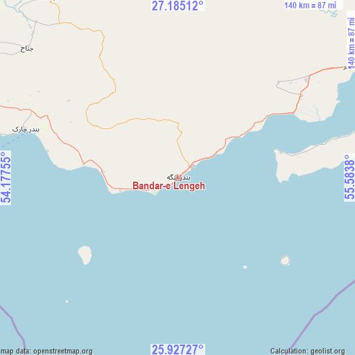
Bandar-e Lengeh GPS coordinates[2]
26° 33' 28.512" North, 54° 52' 50.412" East
| Map corner | latitude | longitude |
|---|---|---|
| Upper-left | 27.18512°, | 54.17755° |
| Center: | 26.55792°, | 54.88067° |
| Lower-right: | 25.92727°, | 55.5838° |
| Map W x H: | 139.9×139.9 km | = 86.9×86.9mi |
| max Lat: | 39.6482° ⇑98.2% North |
| Bandar-e Lengeh: | 26.55792° |
| min Lat: | ⇓1.8% South 25.2919° |
| min Long | Bandar-e Lengeh | max Long |
| 44.38416° | 54.88067° | 61.9965° |
| W 76.2%⇐ | ⇒23.8% E |
Elevation
Elevation of Bandar-e Lengeh is 12 m = 39 ft, and this is 1037 m = 3402 ft below average elevation for this country.
| Max E: |
2564 m = 8412 ft | 90.7% |
| Avg. | 1049 m = 3442 ft | |
| Bandar-e Lengeh | 12 m = 39 ft | |
Min E: |
-24 m = -79 ft | 9.3% |
See also: Iran elevation on elevation.city.
Geographical zone
Bandar-e Lengeh is located in North temperate zone (between Tropic of Cancer and the Arctic Circle). Distance of this Northern Tropic circle is 347 km =215.6 mi to South.| Distance of | km | miles | from Bandar-e Lengeh |
|---|---|---|---|
| North Pole | 7054.1 | 4383.2 | to North |
| Arctic Circle | 4448.2 | 2764 | to North |
| Tropic Cancer | 347 | 215.6 | to South |
| Equator | 2953 | 1834.9 | to South |


Nearby cities:
15 places around Bandar-e Lengeh: (largest is in red/bold)
• Bandar Abbas
155.5 km =96.6 mi,  63°
63°
• Bandar-e Khamīr
82.5 km =51.3 mi, 57°
• Bastak
87.6 km =54.4 mi,  324°
324°
• Dārāb
246.2 km =153 mi,  352°
352°
• Gerāsh
143.9 km =89.4 mi,  329°
329°
• Gāvbandī
196.7 km =122.2 mi,  291°
291°
• Khonj
206 km =128 mi, 316°
• Kīsh
85.7 km =53.3 mi,  269°
269°
• Lamerd
189.5 km =117.7 mi,  297°
297°
• Mohr
226.7 km =140.9 mi, 299°
• Mīnāb
228 km =141.7 mi,  73°
73°
• Qeshm
144.6 km =89.9 mi, 72°
• Shahr-e Qadīm-e Lār
136 km =84.5 mi,  336°
336°
• Ḩājjīābād
205.1 km =127.4 mi, 347°
• Ḩājjīābād
219.2 km =136.2 mi,  27°
27°
Sources, notices
• [Note1] Compared only with cities in Iran existing in our database
• [Src1] Map data: © OpenStreetMap contributors (CC-BY-SA)
• [Src2] Other city data from geonames.org with taken over terms of usage.
• [Src3] Geographical zone / Annual Mean Temperature by Robert A. Rohde @ Wikipedia
