Khūr geodata
Khūr (Isfahan) is a seat of a second-order administrative division; located in Iran in Asia/Tehran (GMT+3.5) time zone. In our database, there are 232 cities with bigger population. Compared to other cities in Iran, 55.6% of cities are located further ↑North; 76.6% of cities are located further ←West and 65.8% of cities have higher elevation than Khūr. Note1


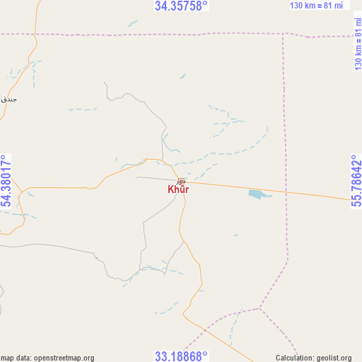
Khūr GPS coordinates[2]
33° 46' 30.432" North, 55° 4' 59.844" East
| Map corner | latitude | longitude |
|---|---|---|
| Upper-left | 34.35758°, | 54.38017° |
| Center: | 33.77512°, | 55.08329° |
| Lower-right: | 33.18868°, | 55.78642° |
| Map W x H: | 130×130 km | = 80.8×80.8mi |
| max Lat: | 39.6482° ⇑55.6% North |
| Khūr: | 33.77512° |
| min Lat: | ⇓44.4% South 25.2919° |
| min Long | Khūr | max Long |
| 44.38416° | 55.08329° | 61.9965° |
| W 76.6%⇐ | ⇒23.4% E |
Elevation
Elevation of Khūr is 831 m = 2726 ft, and this is 218 m = 715 ft below average elevation for this country.
| Max E: |
2564 m = 8412 ft | 65.8% |
| Avg. | 1049 m = 3442 ft | |
| Khūr | 831 m = 2726 ft | |
Min E: |
-24 m = -79 ft | 34.2% |
See also: Iran elevation on elevation.city.
Geographical zone
Khūr is located in North temperate zone (between Tropic of Cancer and the Arctic Circle). Distance of this Northern Tropic circle is 1149.5 km =714.3 mi to South.| Distance of | km | miles | from Khūr |
|---|---|---|---|
| North Pole | 6251.6 | 3884.6 | to North |
| Arctic Circle | 3645.7 | 2265.3 | to North |
| Tropic Cancer | 1149.5 | 714.3 | to South |
| Equator | 3755.4 | 2333.5 | to South |


Nearby cities:
15 places around Khūr: (largest is in red/bold)
• Ardakān
190.8 km =118.6 mi,  211°
211°
• Ardestān
255.3 km =158.6 mi,  259°
259°
• Bahābād
229.3 km =142.5 mi,  157°
157°
• Boshrūyeh
216.9 km =134.8 mi,  87°
87°
• Bāfq
243.3 km =151.2 mi,  172°
172°
• Khavāş Kūh
209.6 km =130.2 mi,  218°
218°
• Mahrīz
250.9 km =155.9 mi,  193°
193°
• Meybod
196.6 km =122.2 mi, 210°
• Nā’īn
211.5 km =131.4 mi,  241°
241°
• Semnan
253.1 km =157.3 mi,  322°
322°
• Sorkheh
253.9 km =157.8 mi, 317°
• Tabas
171.5 km =106.6 mi,  96°
96°
• Taft
238 km =147.9 mi,  199°
199°
• Taft
240.4 km =149.4 mi, 200°
• Yazd
219.2 km =136.2 mi, 197°
Sources, notices
• [Note1] Compared only with cities in Iran existing in our database
• [Src1] Map data: © OpenStreetMap contributors (CC-BY-SA)
• [Src2] Other city data from geonames.org with taken over terms of usage.
• [Src3] Geographical zone / Annual Mean Temperature by Robert A. Rohde @ Wikipedia
