Bahābād geodata
Bahābād (Yazd) is a seat of a second-order administrative division; located in Iran in Asia/Tehran (GMT+3.5) time zone. In our database, there are 232 cities with bigger population. Compared to other cities in Iran, 70.7% of cities are located further ↑North; 80.3% of cities are located further ←West and 65.3% of cities have lower elevation than Bahābād. Note1


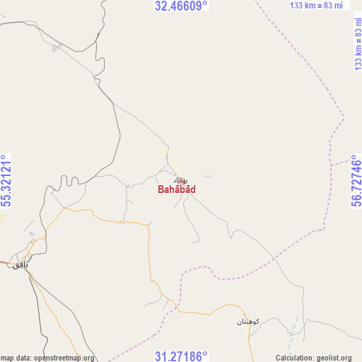
Bahābād GPS coordinates[2]
31° 52' 15.276" North, 56° 1' 27.588" East
| Map corner | latitude | longitude |
|---|---|---|
| Upper-left | 32.46609°, | 55.32121° |
| Center: | 31.87091°, | 56.02433° |
| Lower-right: | 31.27186°, | 56.72746° |
| Map W x H: | 132.8×132.8 km | = 82.5×82.5mi |
| max Lat: | 39.6482° ⇑70.7% North |
| Bahābād: | 31.87091° |
| min Lat: | ⇓29.3% South 25.2919° |
| min Long | Bahābād | max Long |
| 44.38416° | 56.02433° | 61.9965° |
| W 80.3%⇐ | ⇒19.7% E |
Elevation
Elevation of Bahābād is 1404 m = 4606 ft, and this is 355 m = 1165 ft above average elevation for this country.
| Max E: |
2564 m = 8412 ft | 34.7% |
| Bahābād | 1404 m 4606 ft | |
| Avg. | 1049 m = 3442 ft | |
Min E: |
-24 m = -79 ft | 65.3% |
See also: Iran elevation on elevation.city.
Geographical zone
Bahābād is located in North temperate zone (between Tropic of Cancer and the Arctic Circle). Distance of this Northern Tropic circle is 937.8 km =582.7 mi to South.| Distance of | km | miles | from Bahābād |
|---|---|---|---|
| North Pole | 6463.3 | 4016.1 | to North |
| Arctic Circle | 3857.5 | 2396.9 | to North |
| Tropic Cancer | 937.8 | 582.7 | to South |
| Equator | 3543.7 | 2202 | to South |


Nearby cities:
15 places around Bahābād: (largest is in red/bold)
• Anār
132.3 km =82.2 mi,  212°
212°
• Ardakān
195.2 km =121.3 mi,  284°
284°
• Bāfq
65.9 km =40.9 mi,  243°
243°
• Kerman
203.1 km =126.2 mi,  150°
150°
• Kūhbanān
56.8 km =35.3 mi, 154°
• Mahrīz
152.9 km =95 mi,  257°
257°
• Meybod
193.8 km =120.4 mi, 282°
• Rafsanjān
162.8 km =101.2 mi,  181°
181°
• Rāvar
100 km =62.1 mi,  132°
132°
• Shahrak-e Pābedānā
89.2 km =55.4 mi,  156°
156°
• Tabas
209.5 km =130.2 mi,  23°
23°
• Taft
170.6 km =106 mi,  265°
265°
• Taft
172.7 km =107.3 mi, 265°
• Yazd
156.5 km =97.2 mi, 271°
• Zarand
128.3 km =79.7 mi, 156°
Sources, notices
• [Note1] Compared only with cities in Iran existing in our database
• [Src1] Map data: © OpenStreetMap contributors (CC-BY-SA)
• [Src2] Other city data from geonames.org with taken over terms of usage.
• [Src3] Geographical zone / Annual Mean Temperature by Robert A. Rohde @ Wikipedia
