Ardakān geodata
Ardakān (Yazd) is a seat of a second-order administrative division; located in Iran in Asia/Tehran (GMT+3.5) time zone. With population of 58,834 people, there are 111 cities with bigger population in this country. Compared to other cities in Iran, 67.3% of cities are located further ↑North; 71.2% of cities are located further ←West and 56.7% of cities have higher elevation than Ardakān. Note1


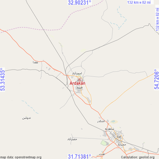
Ardakān GPS coordinates[2]
32° 18' 36.036" North, 54° 1' 2.892" East
| Map corner | latitude | longitude |
|---|---|---|
| Upper-left | 32.90231°, | 53.31435° |
| Center: | 32.31001°, | 54.01747° |
| Lower-right: | 31.71381°, | 54.7206° |
| Map W x H: | 132.1×132.1 km | = 82.1×82.1mi |
| max Lat: | 39.6482° ⇑67.3% North |
| Ardakān: | 32.31001° |
| min Lat: | ⇓32.7% South 25.2919° |
| min Long | Ardakān | max Long |
| 44.38416° | 54.01747° | 61.9965° |
| W 71.2%⇐ | ⇒28.8% E |
Elevation
Elevation of Ardakān is 1040 m = 3412 ft, and this is 9 m = 30 ft below average elevation for this country.
| Max E: |
2564 m = 8412 ft | 56.7% |
| Avg. | 1049 m = 3442 ft | |
| Ardakān | 1040 m = 3412 ft | |
Min E: |
-24 m = -79 ft | 43.3% |
See also: Ardakān elevation on elevation.city.
Geographical zone
Ardakān is located in North temperate zone (between Tropic of Cancer and the Arctic Circle). Distance of this Northern Tropic circle is 986.6 km =613 mi to South.| Distance of | km | miles | from Ardakān |
|---|---|---|---|
| North Pole | 6414.5 | 3985.8 | to North |
| Arctic Circle | 3808.6 | 2366.6 | to North |
| Tropic Cancer | 986.6 | 613 | to South |
| Equator | 3592.5 | 2232.3 | to South |


Nearby cities:
15 places around Ardakān: (largest is in red/bold)
• Abarkūh
148.6 km =92.3 mi,  207°
207°
• Anār
199.2 km =123.8 mi,  143°
143°
• Ardestān
194.3 km =120.7 mi,  307°
307°
• Bahābād
195.2 km =121.3 mi,  104°
104°
• Bāfq
152.5 km =94.8 mi,  121°
121°
• Eqlīd
200.6 km =124.6 mi,  218°
218°
• Khavāş Kūh
32.2 km =20 mi,  269°
269°
• Khūr
190.8 km =118.6 mi,  31°
31°
• Mahrīz
90.1 km =56 mi,  153°
153°
• Meybod
6.7 km =4.2 mi,  180°
180°
• Nā’īn
106.4 km =66.1 mi, 305°
• Taft
64.1 km =39.8 mi,  162°
162°
• Taft
65.3 km =40.6 mi, 164°
• Yazd
56.5 km =35.1 mi, 144°
• Ābādeh
181.8 km =113 mi,  225°
225°
Sources, notices
• [Note1] Compared only with cities in Iran existing in our database
• [Src1] Map data: © OpenStreetMap contributors (CC-BY-SA)
• [Src2] Other city data from geonames.org with taken over terms of usage.
• [Src3] Geographical zone / Annual Mean Temperature by Robert A. Rohde @ Wikipedia
