Mahrīz geodata
Mahrīz (Yazd) is a section of populated place; located in Iran in Asia/Tehran (GMT+3.5) time zone. With population of 36,720 people, there are 163 cities with bigger population in this country. Compared to other cities in Iran, 71.9% of cities are located further ↑North; 74.8% of cities are located further ←West and 68.9% of cities have lower elevation than Mahrīz. Note1


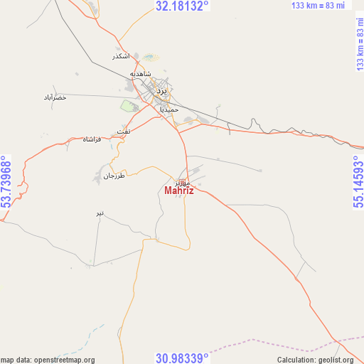
Mahrīz GPS coordinates[2]
31° 35' 3.408" North, 54° 26' 34.08" East
| Map corner | latitude | longitude |
|---|---|---|
| Upper-left | 32.18132°, | 53.73968° |
| Center: | 31.58428°, | 54.4428° |
| Lower-right: | 30.98339°, | 55.14593° |
| Map W x H: | 133.2×133.2 km | = 82.8×82.8mi |
| max Lat: | 39.6482° ⇑71.9% North |
| Mahrīz: | 31.58428° |
| min Lat: | ⇓28.1% South 25.2919° |
| min Long | Mahrīz | max Long |
| 44.38416° | 54.4428° | 61.9965° |
| W 74.8%⇐ | ⇒25.2% E |
Elevation
Elevation of Mahrīz is 1475 m = 4839 ft, and this is 426 m = 1398 ft above average elevation for this country.
| Max E: |
2564 m = 8412 ft | 31.1% |
| Mahrīz | 1475 m 4839 ft | |
| Avg. | 1049 m = 3442 ft | |
Min E: |
-24 m = -79 ft | 68.9% |
See also: Iran elevation on elevation.city.
Geographical zone
Mahrīz is located in North temperate zone (between Tropic of Cancer and the Arctic Circle). Distance of this Northern Tropic circle is 905.9 km =562.9 mi to South.| Distance of | km | miles | from Mahrīz |
|---|---|---|---|
| North Pole | 6495.2 | 4035.9 | to North |
| Arctic Circle | 3889.3 | 2416.7 | to North |
| Tropic Cancer | 905.9 | 562.9 | to South |
| Equator | 3511.8 | 2182.1 | to South |


Nearby cities:
15 places around Mahrīz: (largest is in red/bold)
• Abarkūh
121.3 km =75.4 mi,  245°
245°
• Anār
111.7 km =69.4 mi,  135°
135°
• Ardakān
90.1 km =56 mi,  333°
333°
• Bahābād
152.9 km =95 mi,  77°
77°
• Bāfq
90.9 km =56.5 mi,  88°
88°
• Khavāş Kūh
108.2 km =67.2 mi,  317°
317°
• Kūhbanān
175.5 km =109.1 mi,  96°
96°
• Meybod
84.3 km =52.4 mi, 331°
• Shahr-e Bābak
175.5 km =109.1 mi,  158°
158°
• Shahr-e Herāt
170.3 km =105.8 mi,  182°
182°
• Sūrīān
146.5 km =91 mi,  211°
211°
• Taft
28.6 km =17.8 mi,  313°
313°
• Taft
28.8 km =17.9 mi, 307°
• Yazd
35.5 km =22.1 mi,  348°
348°
• Şafāshahr
160.5 km =99.7 mi,  227°
227°
Sources, notices
• [Note1] Compared only with cities in Iran existing in our database
• [Src1] Map data: © OpenStreetMap contributors (CC-BY-SA)
• [Src2] Other city data from geonames.org with taken over terms of usage.
• [Src3] Geographical zone / Annual Mean Temperature by Robert A. Rohde @ Wikipedia
