Ḩājjīābād geodata
Ḩājjīābād (Khorāsān-e Jonūbī) is a seat of a second-order administrative division; located in Iran in Asia/Tehran (GMT+3.5) time zone. In our database, there are 232 cities with bigger population. Compared to other cities in Iran, 56.9% of cities are located further ↑North; 95.7% of cities are located further ←West and 57.1% of cities have higher elevation than Ḩājjīābād. Note1


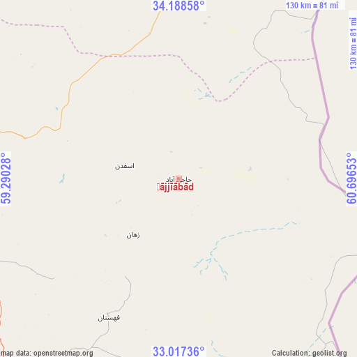
Ḩājjīābād GPS coordinates[2]
33° 36' 17.856" North, 59° 59' 36.24" East
| Map corner | latitude | longitude |
|---|---|---|
| Upper-left | 34.18858°, | 59.29028° |
| Center: | 33.60496°, | 59.9934° |
| Lower-right: | 33.01736°, | 60.69653° |
| Map W x H: | 130.2×130.2 km | = 80.9×80.9mi |
| max Lat: | 39.6482° ⇑56.9% North |
| Ḩājjīābād: | 33.60496° |
| min Lat: | ⇓43.1% South 25.2919° |
| min Long | Ḩājjīābād | max Long |
| 44.38416° | 59.9934° | 61.9965° |
| W 95.7%⇐ | ⇒4.3% E |
Elevation
Elevation of Ḩājjīābād is 1038 m = 3406 ft, and this is 11 m = 36 ft below average elevation for this country.
| Max E: |
2564 m = 8412 ft | 57.1% |
| Avg. | 1049 m = 3442 ft | |
| Ḩājjīābād | 1038 m = 3406 ft | |
Min E: |
-24 m = -79 ft | 42.9% |
See also: Iran elevation on elevation.city.
Geographical zone
Ḩājjīābād is located in North temperate zone (between Tropic of Cancer and the Arctic Circle). Distance of this Northern Tropic circle is 1130.6 km =702.5 mi to South.| Distance of | km | miles | from Ḩājjīābād |
|---|---|---|---|
| North Pole | 6270.5 | 3896.3 | to North |
| Arctic Circle | 3664.7 | 2277.1 | to North |
| Tropic Cancer | 1130.6 | 702.5 | to South |
| Equator | 3736.5 | 2321.8 | to South |


Nearby cities:
15 places around Ḩājjīābād: (largest is in red/bold)
• Asadīyeh
77.9 km =48.4 mi,  199°
199°
• Bajestān
195 km =121.2 mi,  301°
301°
• Bīrjand
109.1 km =67.8 mi,  221°
221°
• Dowlatābād
191.5 km =119 mi,  346°
346°
• Ferdows
174.4 km =108.4 mi,  285°
285°
• Feyẕābād
192.5 km =119.6 mi,  324°
324°
• Gonābād
146.6 km =91.1 mi, 304°
• Khvāf
108.9 km =67.7 mi,  7°
7°
• Qā’en
76.1 km =47.3 mi,  280°
280°
• Roshtkhvār
156.1 km =97 mi, 347°
• Sarbīsheh
115.9 km =72 mi,  189°
189°
• Sarāyān
139 km =86.4 mi, 281°
• Shahrak-e Bākharz
157.1 km =97.6 mi, 10°
• Torbat-e Jām
191.2 km =118.8 mi,  17°
17°
• Tāybād
145.3 km =90.3 mi,  29°
29°
Sources, notices
• [Note1] Compared only with cities in Iran existing in our database
• [Src1] Map data: © OpenStreetMap contributors (CC-BY-SA)
• [Src2] Other city data from geonames.org with taken over terms of usage.
• [Src3] Geographical zone / Annual Mean Temperature by Robert A. Rohde @ Wikipedia
