Bīrjand geodata
Bīrjand (Khorāsān-e Jonūbī) is a seat of a first-order administrative division; located in Iran in Asia/Tehran (GMT+3.5) time zone. With population of 196,982 people, there are 40 cities with bigger population in this country. Compared to other cities in Iran, 61.7% of cities are located further ↑North; 93% of cities are located further ←West and 68.5% of cities have lower elevation than Bīrjand. Note1


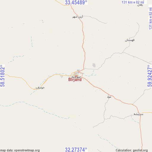
Bīrjand GPS coordinates[2]
32° 51' 58.608" North, 59° 13' 16.104" East
| Map corner | latitude | longitude |
|---|---|---|
| Upper-left | 33.45489°, | 58.51802° |
| Center: | 32.86628°, | 59.22114° |
| Lower-right: | 32.27374°, | 59.92427° |
| Map W x H: | 131.3×131.3 km | = 81.6×81.6mi |
| max Lat: | 39.6482° ⇑61.7% North |
| Bīrjand: | 32.86628° |
| min Lat: | ⇓38.3% South 25.2919° |
| min Long | Bīrjand | max Long |
| 44.38416° | 59.22114° | 61.9965° |
| W 93%⇐ | ⇒7% E |
Elevation
Elevation of Bīrjand is 1459 m = 4787 ft, and this is 410 m = 1345 ft above average elevation for this country.
| Max E: |
2564 m = 8412 ft | 31.5% |
| Bīrjand | 1459 m 4787 ft | |
| Avg. | 1049 m = 3442 ft | |
Min E: |
-24 m = -79 ft | 68.5% |
See also: Bīrjand elevation on elevation.city.
Geographical zone
Bīrjand is located in North temperate zone (between Tropic of Cancer and the Arctic Circle). Distance of this Northern Tropic circle is 1048.5 km =651.5 mi to South.| Distance of | km | miles | from Bīrjand |
|---|---|---|---|
| North Pole | 6352.7 | 3947.4 | to North |
| Arctic Circle | 3746.8 | 2328.2 | to North |
| Tropic Cancer | 1048.5 | 651.5 | to South |
| Equator | 3654.4 | 2270.7 | to South |


Nearby cities:
15 places around Bīrjand: (largest is in red/bold)
• Asadīyeh
47.3 km =29.4 mi,  79°
79°
• Bajestān
207 km =128.6 mi,  332°
332°
• Boshrūyeh
200.3 km =124.5 mi,  303°
303°
• Ferdows
160.9 km =100 mi,  322°
322°
• Feyẕābād
242.7 km =150.8 mi,  350°
350°
• Gonābād
172.6 km =107.2 mi,  343°
343°
• Khvāf
208.3 km =129.4 mi,  24°
24°
• Nehbandān
166 km =103.1 mi,  152°
152°
• Qā’en
95.7 km =59.5 mi,  357°
357°
• Roshtkhvār
237.4 km =147.5 mi,  9°
9°
• Sarbīsheh
62.9 km =39.1 mi,  120°
120°
• Sarāyān
128.2 km =79.7 mi, 329°
• Tabas
228.5 km =142 mi,  290°
290°
• Tāybād
253 km =157.2 mi,  34°
34°
• Ḩājjīābād
109.1 km =67.8 mi,  41°
41°
Sources, notices
• [Note1] Compared only with cities in Iran existing in our database
• [Src1] Map data: © OpenStreetMap contributors (CC-BY-SA)
• [Src2] Other city data from geonames.org with taken over terms of usage.
• [Src3] Geographical zone / Annual Mean Temperature by Robert A. Rohde @ Wikipedia
