Borāzjān geodata
Borāzjān (Bushehr) is a seat of a second-order administrative division; located in Iran in Asia/Tehran (GMT+3.5) time zone. With population of 86,059 people, there are 80 cities with bigger population in this country. Compared to other cities in Iran, 86.4% of cities are located further ↑North; 51% of cities are located further →East and 82.8% of cities have higher elevation than Borāzjān. Note1


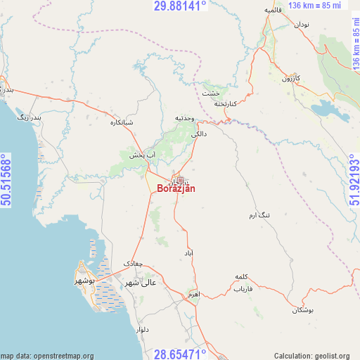
Borāzjān GPS coordinates[2]
29° 16' 11.64" North, 51° 13' 7.68" East
| Map corner | latitude | longitude |
|---|---|---|
| Upper-left | 29.88141°, | 50.51568° |
| Center: | 29.2699°, | 51.2188° |
| Lower-right: | 28.65471°, | 51.92193° |
| Map W x H: | 136.4×136.4 km | = 84.8×84.8mi |
| max Lat: | 39.6482° ⇑86.4% North |
| Borāzjān: | 29.2699° |
| min Lat: | ⇓13.6% South 25.2919° |
| min Long | Borāzjān | max Long |
| 44.38416° | 51.2188° | 61.9965° |
| W 49%⇐ | ⇒51% E |
Elevation
Elevation of Borāzjān is 70 m = 230 ft, and this is 979 m = 3212 ft below average elevation for this country.
| Max E: |
2564 m = 8412 ft | 82.8% |
| Avg. | 1049 m = 3442 ft | |
| Borāzjān | 70 m = 230 ft | |
Min E: |
-24 m = -79 ft | 17.2% |
See also: Borāzjān elevation on elevation.city.
Geographical zone
Borāzjān is located in North temperate zone (between Tropic of Cancer and the Arctic Circle). Distance of this Northern Tropic circle is 648.6 km =403 mi to South.| Distance of | km | miles | from Borāzjān |
|---|---|---|---|
| North Pole | 6752.6 | 4195.9 | to North |
| Arctic Circle | 4146.7 | 2576.6 | to North |
| Tropic Cancer | 648.6 | 403 | to South |
| Equator | 3254.5 | 2022.3 | to South |


Nearby cities:
15 places around Borāzjān: (largest is in red/bold)
• Ahram
43.4 km =27 mi,  172°
172°
• Bandar-e Deylam
134.5 km =83.6 mi,  310°
310°
• Bandar-e Genāveh
76.2 km =47.3 mi,  296°
296°
• Bushehr
50 km =31.1 mi,  227°
227°
• Bāsht
121.5 km =75.5 mi,  357°
357°
• Dogonbadan
127.7 km =79.3 mi,  341°
341°
• Farāshband
95.7 km =59.5 mi,  117°
117°
• Fīrūzābād
139.7 km =86.8 mi,  109°
109°
• Khowrmūj
70.2 km =43.6 mi, 167°
• Khārk
86.2 km =53.6 mi,  269°
269°
• Kāzerūn
57.3 km =35.6 mi,  47°
47°
• Maşīrī
112.4 km =69.8 mi,  15°
15°
• Nūrābād
98.3 km =61.1 mi, 17°
• Sepīdān
132.6 km =82.4 mi,  33°
33°
• Shiraz
132.6 km =82.4 mi,  73°
73°
Sources, notices
• [Note1] Compared only with cities in Iran existing in our database
• [Src1] Map data: © OpenStreetMap contributors (CC-BY-SA)
• [Src2] Other city data from geonames.org with taken over terms of usage.
• [Src3] Geographical zone / Annual Mean Temperature by Robert A. Rohde @ Wikipedia
