Tāybād geodata
Tāybād (Razavi Khorasan) is a seat of a second-order administrative division; located in Iran in Asia/Tehran (GMT+3.5) time zone. With population of 37,513 people, there are 158 cities with bigger population in this country. Compared to other cities in Iran, 53.7% of cities are located further ↓South; 98% of cities are located further ←West and 66.2% of cities have higher elevation than Tāybād. Note1


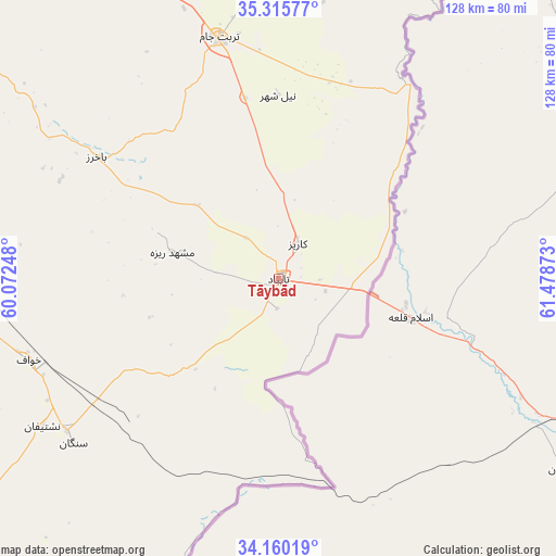
Tāybād GPS coordinates[2]
34° 44' 24" North, 60° 46' 32.16" East
| Map corner | latitude | longitude |
|---|---|---|
| Upper-left | 35.31577°, | 60.07248° |
| Center: | 34.74°, | 60.7756° |
| Lower-right: | 34.16019°, | 61.47873° |
| Map W x H: | 128.5×128.5 km | = 79.8×79.8mi |
| max Lat: | 39.6482° ⇑46.3% North |
| Tāybād: | 34.74° |
| min Lat: | ⇓53.7% South 25.2919° |
| min Long | Tāybād | max Long |
| 44.38416° | 60.7756° | 61.9965° |
| W 98%⇐ | ⇒2% E |
Elevation
Elevation of Tāybād is 811 m = 2661 ft, and this is 238 m = 781 ft below average elevation for this country.
| Max E: |
2564 m = 8412 ft | 66.2% |
| Avg. | 1049 m = 3442 ft | |
| Tāybād | 811 m = 2661 ft | |
Min E: |
-24 m = -79 ft | 33.8% |
See also: Iran elevation on elevation.city.
Geographical zone
Tāybād is located in North temperate zone (between Tropic of Cancer and the Arctic Circle). Distance of this Northern Tropic circle is 1256.8 km =780.9 mi to South.| Distance of | km | miles | from Tāybād |
|---|---|---|---|
| North Pole | 6144.3 | 3817.9 | to North |
| Arctic Circle | 3538.4 | 2198.7 | to North |
| Tropic Cancer | 1256.8 | 780.9 | to South |
| Equator | 3862.7 | 2400.2 | to South |


Nearby cities:
15 places around Tāybād: (largest is in red/bold)
• Dowlatābād
129.3 km =80.3 mi,  297°
297°
• Farīmān
136.5 km =84.8 mi,  321°
321°
• Feyẕābād
184.3 km =114.5 mi,  279°
279°
• Gonābād
196.4 km =122 mi,  257°
257°
• Khvāf
60.8 km =37.8 mi,  252°
252°
• Kāshmar
217.6 km =135.2 mi, 284°
• Mashhad
206.5 km =128.3 mi,  328°
328°
• Qā’en
184.6 km =114.7 mi,  232°
232°
• Roshtkhvār
108.2 km =67.2 mi, 283°
• Sarakhs
203.6 km =126.5 mi,  9°
9°
• Shahrak-e Bākharz
50.3 km =31.3 mi, 303°
• Torbat-e Jām
57.7 km =35.9 mi,  346°
346°
• Torbat-e Ḩeydarīyeh
153.7 km =95.5 mi,  292°
292°
• Ţorqabeh
215.8 km =134.1 mi, 323°
• Ḩājjīābād
145.3 km =90.3 mi,  209°
209°
Sources, notices
• [Note1] Compared only with cities in Iran existing in our database
• [Src1] Map data: © OpenStreetMap contributors (CC-BY-SA)
• [Src2] Other city data from geonames.org with taken over terms of usage.
• [Src3] Geographical zone / Annual Mean Temperature by Robert A. Rohde @ Wikipedia
