Torbat-e Jām geodata
Torbat-e Jām (Razavi Khorasan) is a seat of a second-order administrative division; located in Iran in Asia/Tehran (GMT+3.5) time zone. With population of 58,928 people, there are 109 cities with bigger population in this country. Compared to other cities in Iran, 58.5% of cities are located further ↓South; 97.1% of cities are located further ←West and 63.3% of cities have higher elevation than Torbat-e Jām. Note1


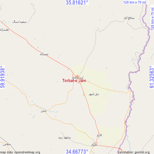
Torbat-e Jām GPS coordinates[2]
35° 14' 38.4" North, 60° 37' 21" East
| Map corner | latitude | longitude |
|---|---|---|
| Upper-left | 35.81621°, | 59.91938° |
| Center: | 35.244°, | 60.6225° |
| Lower-right: | 34.66773°, | 61.32563° |
| Map W x H: | 127.7×127.7 km | = 79.3×79.3mi |
| max Lat: | 39.6482° ⇑41.5% North |
| Torbat-e Jām: | 35.244° |
| min Lat: | ⇓58.5% South 25.2919° |
| min Long | Torbat-e Jām | max Long |
| 44.38416° | 60.6225° | 61.9965° |
| W 97.1%⇐ | ⇒2.9% E |
Elevation
Elevation of Torbat-e Jām is 908 m = 2979 ft, and this is 141 m = 463 ft below average elevation for this country.
| Max E: |
2564 m = 8412 ft | 63.3% |
| Avg. | 1049 m = 3442 ft | |
| Torbat-e Jām | 908 m = 2979 ft | |
Min E: |
-24 m = -79 ft | 36.7% |
See also: Torbat-e Jām elevation on elevation.city.
Geographical zone
Torbat-e Jām is located in North temperate zone (between Tropic of Cancer and the Arctic Circle). Distance of this Northern Tropic circle is 1312.8 km =815.7 mi to South.| Distance of | km | miles | from Torbat-e Jām |
|---|---|---|---|
| North Pole | 6088.3 | 3783.1 | to North |
| Arctic Circle | 3482.4 | 2163.9 | to North |
| Tropic Cancer | 1312.8 | 815.7 | to South |
| Equator | 3918.8 | 2435 | to South |


Nearby cities:
15 places around Torbat-e Jām: (largest is in red/bold)
• Dowlatābād
100.2 km =62.3 mi,  272°
272°
• Farīmān
86.8 km =53.9 mi,  306°
306°
• Feyẕābād
169.1 km =105.1 mi,  261°
261°
• Gonābād
202.9 km =126.1 mi,  240°
240°
• Khvāf
86.3 km =53.6 mi,  210°
210°
• Kāshmar
195.9 km =121.7 mi, 269°
• Mashhad
152.5 km =94.8 mi,  321°
321°
• Neyshābūr
197 km =122.4 mi,  303°
303°
• Roshtkhvār
95.5 km =59.3 mi,  251°
251°
• Sarakhs
152.5 km =94.8 mi,  18°
18°
• Shahrak-e Bākharz
39.4 km =24.5 mi,  224°
224°
• Torbat-e Ḩeydarīyeh
127.4 km =79.2 mi, 271°
• Tāybād
57.7 km =35.9 mi,  166°
166°
• Ţorqabeh
163.6 km =101.7 mi, 316°
• Ḩājjīābād
191.2 km =118.8 mi,  197°
197°
Sources, notices
• [Note1] Compared only with cities in Iran existing in our database
• [Src1] Map data: © OpenStreetMap contributors (CC-BY-SA)
• [Src2] Other city data from geonames.org with taken over terms of usage.
• [Src3] Geographical zone / Annual Mean Temperature by Robert A. Rohde @ Wikipedia
