Abashiri geodata
Abashiri (Hokkaido) is a seat of a second-order administrative division; located in Japan in Asia/Tokyo (GMT+9) time zone. With population of 42,498 people, there are 429 cities with bigger population in this country. Compared to other cities in Japan, 99.4% of cities are located further ↓South; 99.7% of cities are located further ←West and 93.5% of cities have higher elevation than Abashiri. Note1


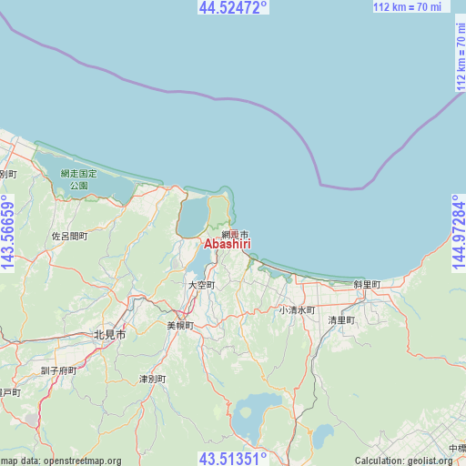
Abashiri GPS coordinates[2]
44° 1' 16.572" North, 144° 16' 10.956" East
| Map corner | latitude | longitude |
|---|---|---|
| Upper-left | 44.52472°, | 143.56659° |
| Center: | 44.02127°, | 144.26971° |
| Lower-right: | 43.51351°, | 144.97284° |
| Map W x H: | 112.4×112.4 km | = 69.8×69.8mi |
| max Lat: | 45.40944° ⇑0.6% North |
| Abashiri: | 44.02127° |
| min Lat: | ⇓99.4% South 24.34478° |
| min Long | Abashiri | max Long |
| 123° | 144.26971° | 145.575° |
| W 99.7%⇐ | ⇒0.3% E |
Elevation
Elevation of Abashiri is 4 m = 13 ft, and this is 80.6 m = 264 ft below average elevation for this country.
| Max E: |
1086 m = 3563 ft | 93.5% |
| Avg. | 84.6 m = 278 ft | |
| Abashiri | 4 m = 13 ft | |
Min E: |
-2 m = -7 ft | 6.5% |
See also: Abashiri elevation on elevation.city.
Geographical zone
Abashiri is located in North temperate zone (between Tropic of Cancer and the Arctic Circle). Distance of this Northern Tropic circle is 2288.8 km =1422.2 mi to South.| Distance of | km | miles | from Abashiri |
|---|---|---|---|
| North Pole | 5112.4 | 3176.7 | to North |
| Arctic Circle | 2506.5 | 1557.5 | to North |
| Tropic Cancer | 2288.8 | 1422.2 | to South |
| Equator | 4894.7 | 3041.4 | to South |


Nearby cities:
15 places around Abashiri: (largest is in red/bold)
• Asahikawa
155.1 km =96.4 mi,  259°
259°
• Furano
169 km =105 mi,  243°
243°
• Kamikawa
121.7 km =75.6 mi, 260°
• Kitami
38.9 km =24.2 mi,  231°
231°
• Kushiro
116.6 km =72.5 mi,  175°
175°
• Mobetsu
77.7 km =48.3 mi,  290°
290°
• Mombetsu
81.9 km =50.9 mi,  296°
296°
• Motomachi
25.7 km =16 mi,  212°
212°
• Nayoro
149 km =92.6 mi,  284°
284°
• Nemuro
130.5 km =81.1 mi,  126°
126°
• Obihiro
149.9 km =93.1 mi,  215°
215°
• Otofuke
143.3 km =89 mi, 216°
• Shibetsu
80 km =49.7 mi,  120°
120°
• Shibetsu
150.6 km =93.6 mi, 276°
• Shimo-furano
169 km =105 mi, 243°
Sources, notices
• [Note1] Compared only with cities in Japan existing in our database
• [Src1] Map data: © OpenStreetMap contributors (CC-BY-SA)
• [Src2] Other city data from geonames.org with taken over terms of usage.
• [Src3] Geographical zone / Annual Mean Temperature by Robert A. Rohde @ Wikipedia
