Jalal-Abad geodata
Jalal-Abad is a seat of a first-order administrative division; located in Kyrgyzstan in Asia/Bishkek (GMT+6) time zone. With population of 75,700 people, there are 2 cities with bigger population in this country. Compared to other cities in Kyrgyzstan, 50% of cities are located further ↓South; 63.1% of cities are located further ←West and 77.4% of cities have higher elevation than Jalal-Abad. Note1


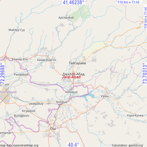
Jalal-Abad GPS coordinates[2]
40° 55' 59.988" North, 73° 0' 0" East
| Map corner | latitude | longitude |
|---|---|---|
| Upper-left | 41.46238°, | 72.29688° |
| Center: | 40.93333°, | 73° |
| Lower-right: | 40.4°, | 73.70313° |
| Map W x H: | 118.1×118.1 km | = 73.4×73.4mi |
| max Lat: | 42.89106° ⇑50% North |
| Jalal-Abad: | 40.93333° |
| min Lat: | ⇓50% South 39.55274° |
| min Long | Jalal-Abad | max Long |
| 69.3716° | 73° | 78.52702° |
| W 63.1%⇐ | ⇒36.9% E |
Elevation
Elevation of Jalal-Abad is 772 m = 2533 ft, and this is 429.4 m = 1409 ft below average elevation for this country.
| Max E: |
2638 m = 8655 ft | 77.4% |
| Avg. | 1201.4 m = 3942 ft | |
| Jalal-Abad | 772 m = 2533 ft | |
Min E: |
504 m = 1654 ft | 22.6% |
See also: Jalal-Abad elevation on elevation.city.
Geographical zone
Jalal-Abad is located in North temperate zone (between Tropic of Cancer and the Arctic Circle). Distance of this Northern Tropic circle is 1945.4 km =1208.8 mi to South.| Distance of | km | miles | from Jalal-Abad |
|---|---|---|---|
| North Pole | 5455.7 | 3390 | to North |
| Arctic Circle | 2849.8 | 1770.8 | to North |
| Tropic Cancer | 1945.4 | 1208.8 | to South |
| Equator | 4551.4 | 2828.1 | to South |


Nearby cities:
15 places around Jalal-Abad: (largest is in red/bold)
• Aravan
62.7 km =39 mi,  222°
222°
• Bazar-Korgon
24.3 km =15.1 mi,  298°
298°
• Gul’cha
78.4 km =48.7 mi,  151°
151°
• Kara Suu
27.8 km =17.3 mi,  203°
203°
• Kara-Kulja
60.1 km =37.3 mi,  123°
123°
• Karavan
98.8 km =61.4 mi, 224°
• Kazarman
100.8 km =62.6 mi,  58°
58°
• Kochkor-Ata
44.9 km =27.9 mi,  284°
284°
• Massy
33.9 km =21.1 mi,  294°
294°
• Nookat
80.9 km =50.3 mi, 203°
• Osh
48.1 km =29.9 mi, 200°
• Suzak
8.9 km =5.5 mi,  243°
243°
• Tash-Kumyr
80 km =49.7 mi, 304°
• Uzgen
31.1 km =19.3 mi,  125°
125°
• Üch-Terek
93.7 km =58.2 mi,  10°
10°
In other languages:
- In France: Djalalabad
- In German: Dschalalabat
- In Italian: Žalalabad
- In Russian: Джалал-Абад
- In Chinese: 賈拉拉巴德
Sources, notices
• [Note1] Compared only with cities in Kyrgyzstan existing in our database
• [Src1] Map data: © OpenStreetMap contributors (CC-BY-SA)
• [Src2] Other city data from geonames.org with taken over terms of usage.
• [Src3] Geographical zone / Annual Mean Temperature by Robert A. Rohde @ Wikipedia
