Ivanovo-Alekseyevka geodata
Ivanovo-Alekseyevka (Talas) is a seat of a second-order administrative division; located in Kyrgyzstan in Asia/Bishkek (GMT+6) time zone. In our database, there are 37 cities with bigger population. Compared to other cities in Kyrgyzstan, 81% of cities are located further ↓South; 53.6% of cities are located further →East and 57.1% of cities have lower elevation than Ivanovo-Alekseyevka. Note1


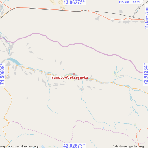
Ivanovo-Alekseyevka GPS coordinates[2]
42° 32' 48.804" North, 72° 12' 33.156" East
| Map corner | latitude | longitude |
|---|---|---|
| Upper-left | 43.06275°, | 71.50609° |
| Center: | 42.54689°, | 72.20921° |
| Lower-right: | 42.02673°, | 72.91234° |
| Map W x H: | 115.2×115.2 km | = 71.6×71.6mi |
| max Lat: | 42.89106° ⇑19% North |
| Ivanovo-Alekseyevka: | 42.54689° |
| min Lat: | ⇓81% South 39.55274° |
| min Long | Ivanovo-Aleksey | max Long |
| 69.3716° | 72.20921° | 78.52702° |
| W 46.4%⇐ | ⇒53.6% E |
Elevation
Elevation of Ivanovo-Alekseyevka is 1209 m = 3967 ft, and this is 7.5999999999999 m = 25 ft above average elevation for this country.
| Max E: |
2638 m = 8655 ft | 42.9% |
| Ivanovo-Alekseyevka | 1209 m 3967 ft | |
| Avg. | 1201.4 m = 3942 ft | |
Min E: |
504 m = 1654 ft | 57.1% |
See also: Kyrgyzstan elevation on elevation.city.
Geographical zone
Ivanovo-Alekseyevka is located in North temperate zone (between Tropic of Cancer and the Arctic Circle). Distance of this Northern Tropic circle is 2124.9 km =1320.4 mi to South.| Distance of | km | miles | from Ivanovo-Alekseyevka |
|---|---|---|---|
| North Pole | 5276.3 | 3278.5 | to North |
| Arctic Circle | 2670.4 | 1659.3 | to North |
| Tropic Cancer | 2124.9 | 1320.4 | to South |
| Equator | 4730.8 | 2939.6 | to South |


Nearby cities:
15 places around Ivanovo-Alekseyevka: (largest is in red/bold)
• Ala-Buka
139.8 km =86.9 mi,  205°
205°
• Bakai-Ata
24.2 km =15 mi,  255°
255°
• Belovodskoye
158.4 km =98.4 mi,  78°
78°
• Kaindy
123.8 km =76.9 mi, 75°
• Kanysh-Kyya
126.6 km =78.7 mi,  226°
226°
• Kara-Balta
137.2 km =85.3 mi, 77°
• Kerben
122.9 km =76.4 mi,  197°
197°
• Kyzyl-Adyr
51.4 km =31.9 mi,  279°
279°
• Pokrovka
53.4 km =33.2 mi,  293°
293°
• Sosnovka
138.4 km =86 mi,  85°
85°
• Talas
3.8 km =2.4 mi,  134°
134°
• Talas
42.5 km =26.4 mi,  120°
120°
• Tash-Kumyr
133.5 km =83 mi,  179°
179°
• Toktogul
96.1 km =59.7 mi,  141°
141°
• Üch-Terek
119.5 km =74.3 mi, 136°
Sources, notices
• [Note1] Compared only with cities in Kyrgyzstan existing in our database
• [Src1] Map data: © OpenStreetMap contributors (CC-BY-SA)
• [Src2] Other city data from geonames.org with taken over terms of usage.
• [Src3] Geographical zone / Annual Mean Temperature by Robert A. Rohde @ Wikipedia
