Kadzhi-Say geodata
Kadzhi-Say (Issyk-Kul) is a populated place; located in Kyrgyzstan in Asia/Bishkek (GMT+6) time zone. With population of 4,000 people, there are 33 cities with bigger population in this country. Compared to other cities in Kyrgyzstan, 69% of cities are located further ↓South; 94% of cities are located further ←West and 85.7% of cities have lower elevation than Kadzhi-Say. Note1


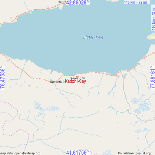
Kadzhi-Say GPS coordinates[2]
42° 8' 27.852" North, 77° 10' 42.528" East
| Map corner | latitude | longitude |
|---|---|---|
| Upper-left | 42.66029°, | 76.47536° |
| Center: | 42.14107°, | 77.17848° |
| Lower-right: | 41.61756°, | 77.88161° |
| Map W x H: | 115.9×115.9 km | = 72×72mi |
| max Lat: | 42.89106° ⇑31% North |
| Kadzhi-Say: | 42.14107° |
| min Lat: | ⇓69% South 39.55274° |
| min Long | Kadzhi-Say | max Long |
| 69.3716° | 77.17848° | 78.52702° |
| W 94%⇐ | ⇒6% E |
Elevation
Elevation of Kadzhi-Say is 1722 m = 5650 ft, and this is 520.6 m = 1708 ft above average elevation for this country.
| Max E: |
2638 m = 8655 ft | 14.3% |
| Kadzhi-Say | 1722 m 5650 ft | |
| Avg. | 1201.4 m = 3942 ft | |
Min E: |
504 m = 1654 ft | 85.7% |
See also: Kyrgyzstan elevation on elevation.city.
Geographical zone
Kadzhi-Say is located in North temperate zone (between Tropic of Cancer and the Arctic Circle). Distance of this Northern Tropic circle is 2079.7 km =1292.3 mi to South.| Distance of | km | miles | from Kadzhi-Say |
|---|---|---|---|
| North Pole | 5321.4 | 3306.6 | to North |
| Arctic Circle | 2715.5 | 1687.3 | to North |
| Tropic Cancer | 2079.7 | 1292.3 | to South |
| Equator | 4685.6 | 2911.5 | to South |


Nearby cities:
15 places around Kadzhi-Say: (largest is in red/bold)
• Ak-Suu
117.8 km =73.2 mi,  70°
70°
• At-Bashi
157.4 km =97.8 mi,  226°
226°
• Balykchy
88.9 km =55.2 mi,  293°
293°
• Bokombayevskoye
15.5 km =9.6 mi,  260°
260°
• Cholpon-Ata
57.1 km =35.5 mi,  352°
352°
• Chuy
172.8 km =107.4 mi,  295°
295°
• Ivanovka
190.6 km =118.4 mi, 295°
• Karakol
107.2 km =66.6 mi, 68°
• Kemin
141.5 km =87.9 mi, 300°
• Kochkor
117.5 km =73 mi,  274°
274°
• Kyzyl-Suu
71.7 km =44.6 mi, 71°
• Naryn
126.4 km =78.5 mi, 231°
• Tokmok
172.5 km =107.2 mi, 296°
• Tossor
21.8 km =13.5 mi,  81°
81°
• Tyup
117.2 km =72.8 mi,  56°
56°
Sources, notices
• [Note1] Compared only with cities in Kyrgyzstan existing in our database
• [Src1] Map data: © OpenStreetMap contributors (CC-BY-SA)
• [Src2] Other city data from geonames.org with taken over terms of usage.
• [Src3] Geographical zone / Annual Mean Temperature by Robert A. Rohde @ Wikipedia
