Chapaev geodata
Chapaev (Batys Qazaqstan) is a populated place; located in Kazakhstan in Asia/Oral (GMT+5) time zone. With population of 6,000 people, there are 173 cities with bigger population in this country. Compared to other cities in Kazakhstan, 66.7% of cities are located further ↓South; 95.9% of cities are located further →East and 93% of cities have higher elevation than Chapaev. Note1


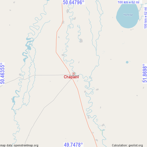
Chapaev GPS coordinates[2]
50° 12' 0" North, 51° 10' 0.012" East
| Map corner | latitude | longitude |
|---|---|---|
| Upper-left | 50.64796°, | 50.46355° |
| Center: | 50.2°, | 51.16667° |
| Lower-right: | 49.7478°, | 51.8698° |
| Map W x H: | 100.1×100.1 km | = 62.2×62.2mi |
| max Lat: | 54.90596° ⇑33.3% North |
| Chapaev: | 50.2° |
| min Lat: | ⇓66.7% South 40.66338° |
| min Long | Chapaev | max Long |
| 46.83361° | 51.16667° | 84.87144° |
| W 4.1%⇐ | ⇒95.9% E |
Elevation
Elevation of Chapaev is 7 m = 23 ft, and this is 349.5 m = 1147 ft below average elevation for this country.
| Max E: |
1847 m = 6060 ft | 93% |
| Avg. | 356.5 m = 1170 ft | |
| Chapaev | 7 m = 23 ft | |
Min E: |
-26 m = -85 ft | 7% |
See also: Kazakhstan elevation on elevation.city.
Geographical zone
Chapaev is located in North temperate zone (between Tropic of Cancer and the Arctic Circle). Distance of this North polar circle is 1819.5 km =1130.6 mi to North.| Distance of | km | miles | from Chapaev |
|---|---|---|---|
| North Pole | 4425.3 | 2749.8 | to North |
| Arctic Circle | 1819.5 | 1130.6 | to North |
| Tropic Cancer | 2975.8 | 1849.1 | to South |
| Equator | 5581.7 | 3468.3 | to South |


Nearby cities:
15 places around Chapaev: (largest is in red/bold)
• Akkol’
215.6 km =134 mi,  137°
137°
• Aqsay
168 km =104.4 mi,  50°
50°
• Burlin
174.5 km =108.4 mi,  38°
38°
• Chingirlau
228.7 km =142.1 mi,  64°
64°
• Dzhambeyty
102.1 km =63.4 mi,  86°
86°
• Dzhangala
124.7 km =77.5 mi,  208°
208°
• Fedorovka
126.4 km =78.5 mi,  26°
26°
• Inderbor
188.8 km =117.3 mi,  166°
166°
• Kaztalovka
183.6 km =114.1 mi,  254°
254°
• Krūgloozernoe
98.1 km =61 mi,  5°
5°
• Miyaly
239.3 km =148.7 mi,  127°
127°
• Oral
115.8 km =72 mi, 6°
• Peremetnoe
113.2 km =70.3 mi,  348°
348°
• Tasqala
118.5 km =73.6 mi,  328°
328°
• Zhumysker
159.3 km =99 mi,  232°
232°
Sources, notices
• [Note1] Compared only with cities in Kazakhstan existing in our database
• [Src1] Map data: © OpenStreetMap contributors (CC-BY-SA)
• [Src2] Other city data from geonames.org with taken over terms of usage.
• [Src3] Geographical zone / Annual Mean Temperature by Robert A. Rohde @ Wikipedia
