Tasqala geodata
Tasqala (Batys Qazaqstan) is a populated place; located in Kazakhstan in Asia/Oral (GMT+5) time zone. With population of 6,980 people, there are 154 cities with bigger population in this country. Compared to other cities in Kazakhstan, 75.6% of cities are located further ↓South; 97% of cities are located further →East and 87.4% of cities have higher elevation than Tasqala. Note1


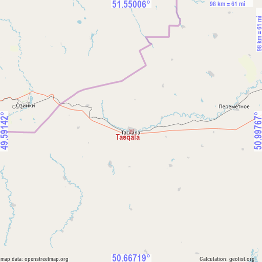
Tasqala GPS coordinates[2]
51° 6' 38.628" North, 50° 17' 40.344" East
| Map corner | latitude | longitude |
|---|---|---|
| Upper-left | 51.55006°, | 49.59142° |
| Center: | 51.11073°, | 50.29454° |
| Lower-right: | 50.66719°, | 50.99767° |
| Map W x H: | 98.2×98.2 km | = 61×61mi |
| max Lat: | 54.90596° ⇑24.4% North |
| Tasqala: | 51.11073° |
| min Lat: | ⇓75.6% South 40.66338° |
| min Long | Tasqala | max Long |
| 46.83361° | 50.29454° | 84.87144° |
| W 3%⇐ | ⇒97% E |
Elevation
Elevation of Tasqala is 69 m = 226 ft, and this is 287.5 m = 943 ft below average elevation for this country.
| Max E: |
1847 m = 6060 ft | 87.4% |
| Avg. | 356.5 m = 1170 ft | |
| Tasqala | 69 m = 226 ft | |
Min E: |
-26 m = -85 ft | 12.6% |
See also: Kazakhstan elevation on elevation.city.
Geographical zone
Tasqala is located in North temperate zone (between Tropic of Cancer and the Arctic Circle). Distance of this North polar circle is 1718.2 km =1067.6 mi to North.| Distance of | km | miles | from Tasqala |
|---|---|---|---|
| North Pole | 4324.1 | 2686.9 | to North |
| Arctic Circle | 1718.2 | 1067.6 | to North |
| Tropic Cancer | 3077.1 | 1912 | to South |
| Equator | 5683 | 3531.3 | to South |


Nearby cities:
15 places around Tasqala: (largest is in red/bold)
• Akkol’
332.3 km =206.5 mi,  141°
141°
• Aqsay
188.7 km =117.3 mi,  88°
88°
• Burlin
171.9 km =106.8 mi,  78°
78°
• Chapaev
118.5 km =73.6 mi,  148°
148°
• Chingirlau
264.6 km =164.4 mi, 90°
• Dzhambeyty
188.1 km =116.9 mi,  120°
120°
• Dzhangala
210.6 km =130.9 mi,  179°
179°
• Fedorovka
116.6 km =72.5 mi, 83°
• Inderbor
304.1 km =189 mi,  159°
159°
• Kaztalovka
187.8 km =116.7 mi,  217°
217°
• Krūgloozernoe
69.6 km =43.2 mi, 92°
• Oral
76 km =47.2 mi, 79°
• Peremetnoe
40.3 km =25 mi, 75°
• Zhumysker
207.6 km =129 mi,  197°
197°
• Zhänibek
308.6 km =191.8 mi,  232°
232°
Sources, notices
• [Note1] Compared only with cities in Kazakhstan existing in our database
• [Src1] Map data: © OpenStreetMap contributors (CC-BY-SA)
• [Src2] Other city data from geonames.org with taken over terms of usage.
• [Src3] Geographical zone / Annual Mean Temperature by Robert A. Rohde @ Wikipedia
