Maqat geodata
Maqat (Atyraū) is a populated place; located in Kazakhstan in Asia/Atyrau (GMT+5) time zone. With population of 14,082 people, there are 83 cities with bigger population in this country. Compared to other cities in Kazakhstan, 58.5% of cities are located further ↑North; 87.8% of cities are located further →East and 99.6% of cities have higher elevation than Maqat. Note1


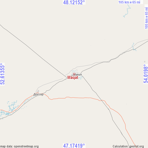
Maqat GPS coordinates[2]
47° 39' 0" North, 53° 19' 0.012" East
| Map corner | latitude | longitude |
|---|---|---|
| Upper-left | 48.12152°, | 52.61355° |
| Center: | 47.65°, | 53.31667° |
| Lower-right: | 47.17419°, | 54.0198° |
| Map W x H: | 105.3×105.3 km | = 65.4×65.4mi |
| max Lat: | 54.90596° ⇑58.5% North |
| Maqat: | 47.65° |
| min Lat: | ⇓41.5% South 40.66338° |
| min Long | Maqat | max Long |
| 46.83361° | 53.31667° | 84.87144° |
| W 12.2%⇐ | ⇒87.8% E |
Elevation
Elevation of Maqat is -25 m = -82 ft, and this is 381.5 m = 1252 ft below average elevation for this country.
| Max E: |
1847 m = 6060 ft | 99.6% |
| Avg. | 356.5 m = 1170 ft | |
| Maqat | -25 m = -82 ft | |
Min E: |
-26 m = -85 ft | 0.4% |
See also: Kazakhstan elevation on elevation.city.
Geographical zone
Maqat is located in North temperate zone (between Tropic of Cancer and the Arctic Circle). Distance of this North polar circle is 2103 km =1306.7 mi to North.| Distance of | km | miles | from Maqat |
|---|---|---|---|
| North Pole | 4708.9 | 2926 | to North |
| Arctic Circle | 2103 | 1306.7 | to North |
| Tropic Cancer | 2692.3 | 1672.9 | to South |
| Equator | 5298.2 | 3292.1 | to South |


Nearby cities:
15 places around Maqat: (largest is in red/bold)
• Akkol’
125.1 km =77.7 mi,  355°
355°
• Atyrau
123.1 km =76.5 mi,  241°
241°
• Balykshi
127 km =78.9 mi, 239°
• Bayganin
222.2 km =138.1 mi,  58°
58°
• Bayshonas
53.5 km =33.2 mi,  211°
211°
• Biikzhal
142.2 km =88.4 mi,  131°
131°
• Dossor
28.6 km =17.8 mi, 241°
• Dzhambeyty
294.5 km =183 mi,  349°
349°
• Dzhangala
280.6 km =174.4 mi,  308°
308°
• Inderbor
151.6 km =94.2 mi, 311°
• Makhambet
129.8 km =80.7 mi,  270°
270°
• Miyaly
141.8 km =88.1 mi,  14°
14°
• Qaraton
135.7 km =84.3 mi,  174°
174°
• Qulsary
93.9 km =58.3 mi,  145°
145°
• Shubarkuduk
286.7 km =178.1 mi,  54°
54°
Sources, notices
• [Note1] Compared only with cities in Kazakhstan existing in our database
• [Src1] Map data: © OpenStreetMap contributors (CC-BY-SA)
• [Src2] Other city data from geonames.org with taken over terms of usage.
• [Src3] Geographical zone / Annual Mean Temperature by Robert A. Rohde @ Wikipedia
