Akkol’ geodata
Akkol’ (Atyraū) is a populated place; located in Kazakhstan in Asia/Atyrau (GMT+5) time zone. With population of 4,245 people, there are 206 cities with bigger population in this country. Compared to other cities in Kazakhstan, 50% of cities are located further ↓South; 88.1% of cities are located further →East and 92.2% of cities have higher elevation than Akkol’. Note1


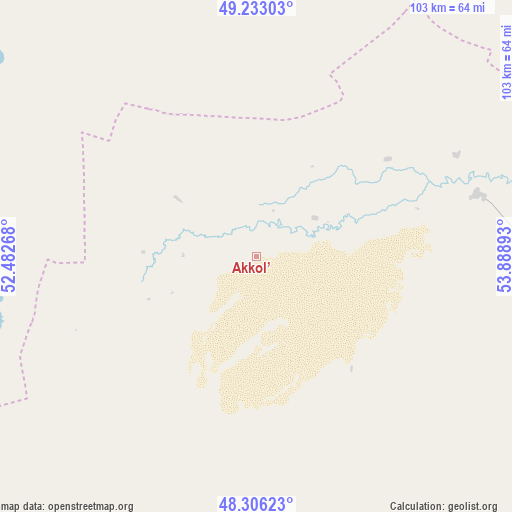
Akkol’ GPS coordinates[2]
48° 46' 18.372" North, 53° 11' 8.88" East
| Map corner | latitude | longitude |
|---|---|---|
| Upper-left | 49.23303°, | 52.48268° |
| Center: | 48.77177°, | 53.1858° |
| Lower-right: | 48.30623°, | 53.88893° |
| Map W x H: | 103.1×10³ km | = 64.1×64mi |
| max Lat: | 54.90596° ⇑50% North |
| Akkol’: | 48.77177° |
| min Lat: | ⇓50% South 40.66338° |
| min Long | Akkol’ | max Long |
| 46.83361° | 53.1858° | 84.87144° |
| W 11.9%⇐ | ⇒88.1% E |
Elevation
Elevation of Akkol’ is 13 m = 43 ft, and this is 343.5 m = 1127 ft below average elevation for this country.
| Max E: |
1847 m = 6060 ft | 92.2% |
| Avg. | 356.5 m = 1170 ft | |
| Akkol’ | 13 m = 43 ft | |
Min E: |
-26 m = -85 ft | 7.8% |
See also: Kazakhstan elevation on elevation.city.
Geographical zone
Akkol’ is located in North temperate zone (between Tropic of Cancer and the Arctic Circle). Distance of this North polar circle is 1978.3 km =1229.3 mi to North.| Distance of | km | miles | from Akkol’ |
|---|---|---|---|
| North Pole | 4584.1 | 2848.4 | to North |
| Arctic Circle | 1978.3 | 1229.3 | to North |
| Tropic Cancer | 2817 | 1750.4 | to South |
| Equator | 5422.9 | 3369.6 | to South |


Nearby cities:
15 places around Akkol’: (largest is in red/bold)
• Atyrau
208 km =129.2 mi,  207°
207°
• Balykshi
213.5 km =132.7 mi, 207°
• Bayganin
197.4 km =122.7 mi,  92°
92°
• Bayshonas
171.1 km =106.3 mi,  186°
186°
• Biikzhal
247.8 km =154 mi,  152°
152°
• Chapaev
215.6 km =134 mi,  317°
317°
• Dossor
139.2 km =86.5 mi, 186°
• Dzhambeyty
170.5 km =105.9 mi,  345°
345°
• Dzhangala
213.9 km =132.9 mi,  283°
283°
• Inderbor
105.9 km =65.8 mi,  256°
256°
• Makhambet
170.8 km =106.1 mi,  224°
224°
• Maqat
125.1 km =77.7 mi,  175°
175°
• Miyaly
46.1 km =28.6 mi,  74°
74°
• Qulsary
211.6 km =131.5 mi,  162°
162°
• Shubarkuduk
244.2 km =151.7 mi,  80°
80°
Sources, notices
• [Note1] Compared only with cities in Kazakhstan existing in our database
• [Src1] Map data: © OpenStreetMap contributors (CC-BY-SA)
• [Src2] Other city data from geonames.org with taken over terms of usage.
• [Src3] Geographical zone / Annual Mean Temperature by Robert A. Rohde @ Wikipedia
