Qulsary geodata
Qulsary (Atyraū) is a populated place; located in Kazakhstan in Asia/Atyrau (GMT+5) time zone. With population of 51,216 people, there are 28 cities with bigger population in this country. Compared to other cities in Kazakhstan, 62.6% of cities are located further ↑North; 86.3% of cities are located further →East and 95.9% of cities have higher elevation than Qulsary. Note1


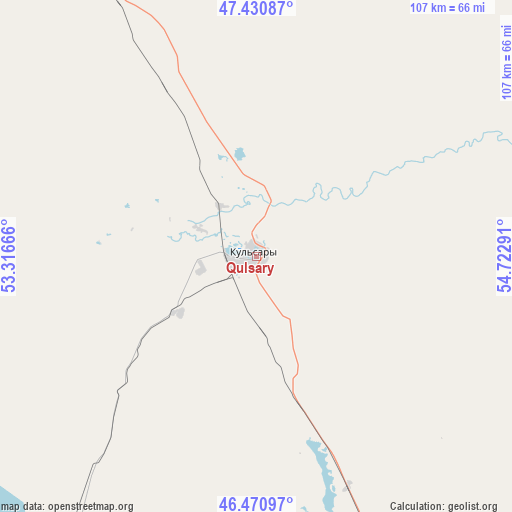
Qulsary GPS coordinates[2]
46° 57' 11.052" North, 54° 1' 11.208" East
| Map corner | latitude | longitude |
|---|---|---|
| Upper-left | 47.43087°, | 53.31666° |
| Center: | 46.95307°, | 54.01978° |
| Lower-right: | 46.47097°, | 54.72291° |
| Map W x H: | 106.7×106.7 km | = 66.3×66.3mi |
| max Lat: | 54.90596° ⇑62.6% North |
| Qulsary: | 46.95307° |
| min Lat: | ⇓37.4% South 40.66338° |
| min Long | Qulsary | max Long |
| 46.83361° | 54.01978° | 84.87144° |
| W 13.7%⇐ | ⇒86.3% E |
Elevation
Elevation of Qulsary is -14 m = -46 ft, and this is 370.5 m = 1216 ft below average elevation for this country.
| Max E: |
1847 m = 6060 ft | 95.9% |
| Avg. | 356.5 m = 1170 ft | |
| Qulsary | -14 m = -46 ft | |
Min E: |
-26 m = -85 ft | 4.1% |
See also: Qulsary elevation on elevation.city.
Geographical zone
Qulsary is located in North temperate zone (between Tropic of Cancer and the Arctic Circle). Distance of this North polar circle is 2180.5 km =1354.9 mi to North.| Distance of | km | miles | from Qulsary |
|---|---|---|---|
| North Pole | 4786.4 | 2974.1 | to North |
| Arctic Circle | 2180.5 | 1354.9 | to North |
| Tropic Cancer | 2614.8 | 1624.8 | to South |
| Equator | 5220.7 | 3244 | to South |


Nearby cities:
15 places around Qulsary: (largest is in red/bold)
• Akkol’
211.6 km =131.5 mi,  342°
342°
• Atyrau
162.9 km =101.2 mi,  276°
276°
• Balykshi
163.7 km =101.7 mi,  274°
274°
• Bayganin
237.6 km =147.6 mi,  35°
35°
• Bayshonas
87.7 km =54.5 mi,  291°
291°
• Beyneu
203.4 km =126.4 mi,  153°
153°
• Biikzhal
55.9 km =34.7 mi,  108°
108°
• Dossor
101.1 km =62.8 mi,  309°
309°
• Inderbor
243.9 km =151.6 mi,  316°
316°
• Makhambet
200.1 km =124.3 mi, 293°
• Maqat
93.9 km =58.3 mi,  325°
325°
• Miyaly
215.5 km =133.9 mi,  355°
355°
• Qaraton
70.5 km =43.8 mi,  215°
215°
• Sayötesh
294.3 km =182.9 mi,  187°
187°
• Shubarshi
297.6 km =184.9 mi,  52°
52°
Sources, notices
• [Note1] Compared only with cities in Kazakhstan existing in our database
• [Src1] Map data: © OpenStreetMap contributors (CC-BY-SA)
• [Src2] Other city data from geonames.org with taken over terms of usage.
• [Src3] Geographical zone / Annual Mean Temperature by Robert A. Rohde @ Wikipedia
