Shubarkuduk geodata
Shubarkuduk (Aqtöbe) is a populated place; located in Kazakhstan in Asia/Aqtobe (GMT+5) time zone. With population of 11,733 people, there are 101 cities with bigger population in this country. Compared to other cities in Kazakhstan, 53.3% of cities are located further ↓South; 84.4% of cities are located further →East and 68.1% of cities have higher elevation than Shubarkuduk. Note1


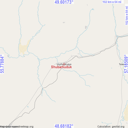
Shubarkuduk GPS coordinates[2]
49° 8' 38.076" North, 56° 28' 55.056" East
| Map corner | latitude | longitude |
|---|---|---|
| Upper-left | 49.60173°, | 55.77884° |
| Center: | 49.14391°, | 56.48196° |
| Lower-right: | 48.68182°, | 57.18509° |
| Map W x H: | 102.3×102.3 km | = 63.6×63.6mi |
| max Lat: | 54.90596° ⇑46.7% North |
| Shubarkuduk: | 49.14391° |
| min Lat: | ⇓53.3% South 40.66338° |
| min Long | Shubarkuduk | max Long |
| 46.83361° | 56.48196° | 84.87144° |
| W 15.6%⇐ | ⇒84.4% E |
Elevation
Elevation of Shubarkuduk is 191 m = 627 ft, and this is 165.5 m = 543 ft below average elevation for this country.
| Max E: |
1847 m = 6060 ft | 68.1% |
| Avg. | 356.5 m = 1170 ft | |
| Shubarkuduk | 191 m = 627 ft | |
Min E: |
-26 m = -85 ft | 31.9% |
See also: Kazakhstan elevation on elevation.city.
Geographical zone
Shubarkuduk is located in North temperate zone (between Tropic of Cancer and the Arctic Circle). Distance of this North polar circle is 1936.9 km =1203.5 mi to North.| Distance of | km | miles | from Shubarkuduk |
|---|---|---|---|
| North Pole | 4542.8 | 2822.8 | to North |
| Arctic Circle | 1936.9 | 1203.5 | to North |
| Tropic Cancer | 2858.4 | 1776.1 | to South |
| Equator | 5464.3 | 3395.4 | to South |


Nearby cities:
15 places around Shubarkuduk: (largest is in red/bold)
• Akkol’
244.2 km =151.7 mi,  260°
260°
• Aktobe
136.6 km =84.9 mi,  22°
22°
• Batamshinskiy
203.4 km =126.4 mi,  39°
39°
• Bayganin
67.2 km =41.8 mi,  221°
221°
• Biikzhal
292.3 km =181.6 mi,  206°
206°
• Chingirlau
276.5 km =171.8 mi,  321°
321°
• Embi
126.6 km =78.7 mi,  106°
106°
• Kandyagash
77 km =47.8 mi,  61°
61°
• Khromtau
187 km =116.2 mi,  48°
48°
• Maqat
286.7 km =178.1 mi,  234°
234°
• Martuk
178.3 km =110.8 mi,  0°
0°
• Miyaly
198.3 km =123.2 mi, 261°
• Shalqar
272.1 km =169.1 mi,  122°
122°
• Shubarshi
81 km =50.3 mi,  140°
140°
• Temir
47 km =29.2 mi,  90°
90°
Sources, notices
• [Note1] Compared only with cities in Kazakhstan existing in our database
• [Src1] Map data: © OpenStreetMap contributors (CC-BY-SA)
• [Src2] Other city data from geonames.org with taken over terms of usage.
• [Src3] Geographical zone / Annual Mean Temperature by Robert A. Rohde @ Wikipedia
