Qaraton geodata
Qaraton (Atyraū) is a populated place; located in Kazakhstan in Asia/Atyrau (GMT+5) time zone. With population of 8,905 people, there are 132 cities with bigger population in this country. Compared to other cities in Kazakhstan, 65.9% of cities are located further ↑North; 87.4% of cities are located further →East and 100% of cities have higher elevation than Qaraton. Note1


Qaraton GPS coordinates[2]
46° 26' 7.008" North, 53° 29' 11.004" East
| Map corner | latitude | longitude |
|---|---|---|
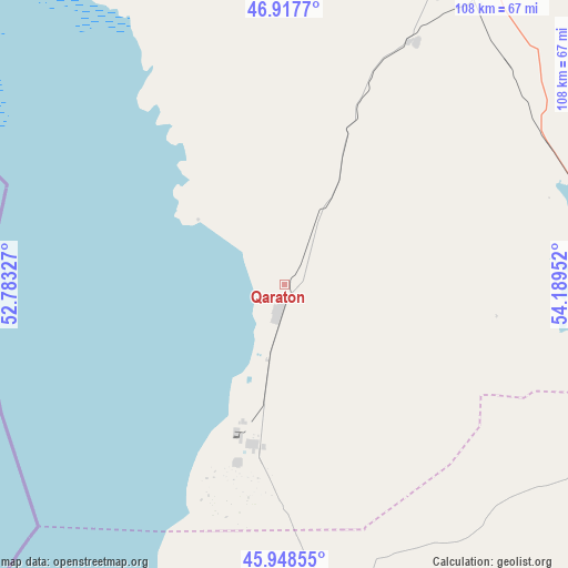
| Upper-left | 46.9177°, | 52.78327° |
| Center: | 46.43528°, | 53.48639° |
| Lower-right: | 45.94855°, | 54.18952° |
| Map W x H: | 107.8×107.8 km | = 67×67mi |
| max Lat: | 54.90596° ⇑65.9% North |
| Qaraton: | 46.43528° |
| min Lat: | ⇓34.1% South 40.66338° |
| min Long | Qaraton | max Long |
| 46.83361° | 53.48639° | 84.87144° |
| W 12.6%⇐ | ⇒87.4% E |
Elevation
Elevation of Qaraton is -26 m = -85 ft, and this is 382.5 m = 1255 ft below average elevation for this country.
| Max E: |
1847 m = 6060 ft | 100% |
| Avg. | 356.5 m = 1170 ft | |
| Qaraton | -26 m = -85 ft | |
Min E: |
-26 m = -85 ft | 0% |
See also: Kazakhstan elevation on elevation.city.
Geographical zone
Qaraton is located in North temperate zone (between Tropic of Cancer and the Arctic Circle). Distance of this North polar circle is 2238.1 km =1390.7 mi to North.| Distance of | km | miles | from Qaraton |
|---|---|---|---|
| North Pole | 4843.9 | 3009.9 | to North |
| Arctic Circle | 2238.1 | 1390.7 | to North |
| Tropic Cancer | 2557.2 | 1589 | to South |
| Equator | 5163.1 | 3208.2 | to South |


Nearby cities:
15 places around Qaraton: (largest is in red/bold)
• Akkol’
260.8 km =162.1 mi,  355°
355°
• Atyrau
143.7 km =89.3 mi,  301°
301°
• Balykshi
142 km =88.2 mi, 299°
• Bayshonas
98.8 km =61.4 mi,  335°
335°
• Beyneu
181.8 km =113 mi,  133°
133°
• Biikzhal
102.2 km =63.5 mi,  66°
66°
• Dossor
127.3 km =79.1 mi, 342°
• Inderbor
267.7 km =166.3 mi,  331°
331°
• Makhambet
198.8 km =123.5 mi,  313°
313°
• Maqat
135.7 km =84.3 mi,  354°
354°
• Miyaly
273.3 km =169.8 mi,  4°
4°
• Qulsary
70.5 km =43.8 mi,  35°
35°
• Sayötesh
234.4 km =145.6 mi,  179°
179°
• Shetpe
274 km =170.3 mi,  203°
203°
• Taūshyq
285.9 km =177.7 mi,  215°
215°
Sources, notices
• [Note1] Compared only with cities in Kazakhstan existing in our database
• [Src1] Map data: © OpenStreetMap contributors (CC-BY-SA)
• [Src2] Other city data from geonames.org with taken over terms of usage.
• [Src3] Geographical zone / Annual Mean Temperature by Robert A. Rohde @ Wikipedia
