Miyaly geodata
Miyaly (Atyraū) is a populated place; located in Kazakhstan in Asia/Atyrau (GMT+5) time zone. With population of 6,213 people, there are 167 cities with bigger population in this country. Compared to other cities in Kazakhstan, 51.9% of cities are located further ↓South; 86.7% of cities are located further →East and 90% of cities have higher elevation than Miyaly. Note1


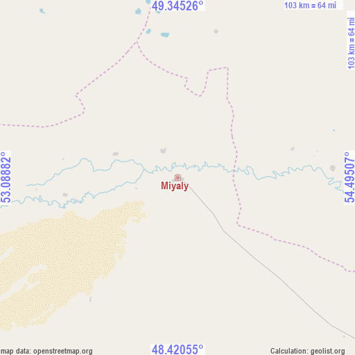
Miyaly GPS coordinates[2]
48° 53' 6.144" North, 53° 47' 30.984" East
| Map corner | latitude | longitude |
|---|---|---|
| Upper-left | 49.34526°, | 53.08882° |
| Center: | 48.88504°, | 53.79194° |
| Lower-right: | 48.42055°, | 54.49507° |
| Map W x H: | 102.8×102.8 km | = 63.9×63.9mi |
| max Lat: | 54.90596° ⇑48.1% North |
| Miyaly: | 48.88504° |
| min Lat: | ⇓51.9% South 40.66338° |
| min Long | Miyaly | max Long |
| 46.83361° | 53.79194° | 84.87144° |
| W 13.3%⇐ | ⇒86.7% E |
Elevation
Elevation of Miyaly is 33 m = 108 ft, and this is 323.5 m = 1061 ft below average elevation for this country.
| Max E: |
1847 m = 6060 ft | 90% |
| Avg. | 356.5 m = 1170 ft | |
| Miyaly | 33 m = 108 ft | |
Min E: |
-26 m = -85 ft | 10% |
See also: Kazakhstan elevation on elevation.city.
Geographical zone
Miyaly is located in North temperate zone (between Tropic of Cancer and the Arctic Circle). Distance of this North polar circle is 1965.7 km =1221.4 mi to North.| Distance of | km | miles | from Miyaly |
|---|---|---|---|
| North Pole | 4571.6 | 2840.7 | to North |
| Arctic Circle | 1965.7 | 1221.4 | to North |
| Tropic Cancer | 2829.6 | 1758.2 | to South |
| Equator | 5435.5 | 3377.5 | to South |


Nearby cities:
15 places around Miyaly: (largest is in red/bold)
• Akkol’
46.1 km =28.6 mi,  254°
254°
• Atyrau
242.5 km =150.7 mi,  215°
215°
• Bayganin
154.1 km =95.8 mi,  98°
98°
• Bayshonas
193.4 km =120.2 mi,  199°
199°
• Biikzhal
242.4 km =150.6 mi,  163°
163°
• Chapaev
239.3 km =148.7 mi,  307°
307°
• Chingirlau
247 km =153.5 mi,  4°
4°
• Dossor
162.5 km =101 mi, 201°
• Dzhambeyty
175.1 km =108.8 mi,  330°
330°
• Inderbor
152 km =94.4 mi,  255°
255°
• Makhambet
212.3 km =131.9 mi,  230°
230°
• Maqat
141.8 km =88.1 mi,  194°
194°
• Qulsary
215.5 km =133.9 mi,  175°
175°
• Shubarkuduk
198.3 km =123.2 mi,  81°
81°
• Temir
245 km =152.2 mi, 83°
Sources, notices
• [Note1] Compared only with cities in Kazakhstan existing in our database
• [Src1] Map data: © OpenStreetMap contributors (CC-BY-SA)
• [Src2] Other city data from geonames.org with taken over terms of usage.
• [Src3] Geographical zone / Annual Mean Temperature by Robert A. Rohde @ Wikipedia
