Sayötesh geodata
Sayötesh (Mangghystaū) is a populated place; located in Kazakhstan in Asia/Aqtau (GMT+5) time zone. With population of 1,571 people, there are 251 cities with bigger population in this country. Compared to other cities in Kazakhstan, 77.8% of cities are located further ↑North; 87% of cities are located further →East and 61.9% of cities have higher elevation than Sayötesh. Note1


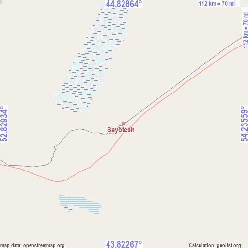
Sayötesh GPS coordinates[2]
44° 19' 40.116" North, 53° 31' 56.856" East
| Map corner | latitude | longitude |
|---|---|---|
| Upper-left | 44.82864°, | 52.82934° |
| Center: | 44.32781°, | 53.53246° |
| Lower-right: | 43.82267°, | 54.23559° |
| Map W x H: | 111.9×111.9 km | = 69.5×69.5mi |
| max Lat: | 54.90596° ⇑77.8% North |
| Sayötesh: | 44.32781° |
| min Lat: | ⇓22.2% South 40.66338° |
| min Long | Sayötesh | max Long |
| 46.83361° | 53.53246° | 84.87144° |
| W 13%⇐ | ⇒87% E |
Elevation
Elevation of Sayötesh is 228 m = 748 ft, and this is 128.5 m = 422 ft below average elevation for this country.
| Max E: |
1847 m = 6060 ft | 61.9% |
| Avg. | 356.5 m = 1170 ft | |
| Sayötesh | 228 m = 748 ft | |
Min E: |
-26 m = -85 ft | 38.1% |
See also: Kazakhstan elevation on elevation.city.
Geographical zone
Sayötesh is located in North temperate zone (between Tropic of Cancer and the Arctic Circle). Distance of this Northern Tropic circle is 2322.9 km =1443.4 mi to South.| Distance of | km | miles | from Sayötesh |
|---|---|---|---|
| North Pole | 5078.3 | 3155.5 | to North |
| Arctic Circle | 2472.4 | 1536.3 | to North |
| Tropic Cancer | 2322.9 | 1443.4 | to South |
| Equator | 4928.8 | 3062.6 | to South |


Nearby cities:
15 places around Sayötesh: (largest is in red/bold)
• Aktau
203.7 km =126.6 mi,  248°
248°
• Bayshonas
327.2 km =203.3 mi,  351°
351°
• Baūtīno
262 km =162.8 mi,  275°
275°
• Beyneu
171.4 km =106.5 mi,  50°
50°
• Biikzhal
289.4 km =179.8 mi,  18°
18°
• Fort-Shevchenko
260.3 km =161.7 mi,  274°
274°
• Munayshy
147.2 km =91.5 mi,  230°
230°
• Qaraton
234.4 km =145.6 mi,  359°
359°
• Qulsary
294.3 km =182.9 mi,  7°
7°
• Shetpe
114.2 km =71 mi,  260°
260°
• Taūshyq
173.6 km =107.9 mi, 270°
• Yeraliyev
195.9 km =121.7 mi, 229°
• Zhanaozen
122.2 km =75.9 mi,  206°
206°
• Zhetibay
142.1 km =88.3 mi, 234°
• Ömirzaq
200.5 km =124.6 mi, 246°
Sources, notices
• [Note1] Compared only with cities in Kazakhstan existing in our database
• [Src1] Map data: © OpenStreetMap contributors (CC-BY-SA)
• [Src2] Other city data from geonames.org with taken over terms of usage.
• [Src3] Geographical zone / Annual Mean Temperature by Robert A. Rohde @ Wikipedia
