Ömirzaq geodata
Ömirzaq (Mangghystaū) is a populated place; located in Kazakhstan in Asia/Aqtau (GMT+5) time zone. With population of 1,885 people, there are 247 cities with bigger population in this country. Compared to other cities in Kazakhstan, 82.2% of cities are located further ↑North; 95.2% of cities are located further →East and 99.6% of cities have higher elevation than Ömirzaq. Note1


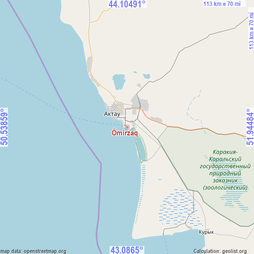
Ömirzaq GPS coordinates[2]
43° 35' 52.296" North, 51° 14' 30.156" East
| Map corner | latitude | longitude |
|---|---|---|
| Upper-left | 44.10491°, | 50.53859° |
| Center: | 43.59786°, | 51.24171° |
| Lower-right: | 43.0865°, | 51.94484° |
| Map W x H: | 113.2×113.2 km | = 70.3×70.3mi |
| max Lat: | 54.90596° ⇑82.2% North |
| Ömirzaq: | 43.59786° |
| min Lat: | ⇓17.8% South 40.66338° |
| min Long | Ömirzaq | max Long |
| 46.83361° | 51.24171° | 84.87144° |
| W 4.8%⇐ | ⇒95.2% E |
Elevation
Elevation of Ömirzaq is -25 m = -82 ft, and this is 381.5 m = 1252 ft below average elevation for this country.
| Max E: |
1847 m = 6060 ft | 99.6% |
| Avg. | 356.5 m = 1170 ft | |
| Ömirzaq | -25 m = -82 ft | |
Min E: |
-26 m = -85 ft | 0.4% |
See also: Kazakhstan elevation on elevation.city.
Geographical zone
Ömirzaq is located in North temperate zone (between Tropic of Cancer and the Arctic Circle). Distance of this Northern Tropic circle is 2241.7 km =1392.9 mi to South.| Distance of | km | miles | from Ömirzaq |
|---|---|---|---|
| North Pole | 5159.4 | 3205.9 | to North |
| Arctic Circle | 2553.5 | 1586.7 | to North |
| Tropic Cancer | 2241.7 | 1392.9 | to South |
| Equator | 4847.6 | 3012.2 | to South |


Nearby cities:
14 places around Ömirzaq: (largest is in red/bold)
• Aktau
8.4 km =5.2 mi,  313°
313°
• Atyrau
394.4 km =245.1 mi,  7°
7°
• Balykshi
388.8 km =241.6 mi, 7°
• Baūtīno
131.9 km =82 mi,  322°
322°
• Fort-Shevchenko
127.7 km =79.3 mi, 322°
• Maloye Ganyushkino
368 km =228.7 mi,  335°
335°
• Munayshy
70.9 km =44.1 mi,  99°
99°
• Qaraton
361.4 km =224.6 mi,  29°
29°
• Sayötesh
200.5 km =124.6 mi,  66°
66°
• Shetpe
94.4 km =58.7 mi,  47°
47°
• Taūshyq
83.7 km =52 mi, 5°
• Yeraliyev
58.4 km =36.3 mi,  142°
142°
• Zhanaozen
133.8 km =83.1 mi, 102°
• Zhetibay
67.4 km =41.9 mi,  90°
90°
Sources, notices
• [Note1] Compared only with cities in Kazakhstan existing in our database
• [Src1] Map data: © OpenStreetMap contributors (CC-BY-SA)
• [Src2] Other city data from geonames.org with taken over terms of usage.
• [Src3] Geographical zone / Annual Mean Temperature by Robert A. Rohde @ Wikipedia
